8:30 P.M.

Summer is back!
Hi everybody! I have some good news for you sun lovers. It looks like we have a warm week on tap. Remember that powerful wave I was talking about? As expected, the situation changed, and now it is heading north of us as a strong upper level ridge builds over the area. This will give us one last stretch of warm temperatures and mostly sunny skies.
Take a look at the model below...

Valid 11:00 am PDT Mon, 19 Sep 2011 - 18hr Fcst - UW 36km 00z MM5-NAM 1000-500mb thickness
You can see a large low spinning in the Gulf of Alaska. However, you can also see that it is bring warm air up from the eastern Pacific and cool air down from Alaska on the western side of the storm. It almost looks like a yin-yang sign. Anyway, what this low pressure system is doing is actually creating a ridge of high pressure east of it. You can clearly see the ridge in the upper atmosphere, marked by those blue lines.
The saying "the calm before the storm" actually holds some truth, because while air is rising at the storm's center, air is sinking ahead of it, creating fewer clouds and higher precipitation. When the Pacific Northwest is continually getting battered by storms during the winter, the driest periods are often before major systems that come in because there are weak ridges of high pressure in front of them.
A few frames later, you can really see the ridge building over the Pacific Northwest, stretching all the way up into northern Canada.

Valid 05:00 pm PDT Tue, 20 Sep 2011 - 48hr Fcst - UW 36km 00z MM5-NAM 1000-500mb thickness
With the deep low pressure continually bringing up warm air from the south and forming an upper level ridge, the Pacific Northwest will experience few clouds over the next week and sunny temperatures.
A frame of the jet stream from the same time clearly shows the ridge as well.
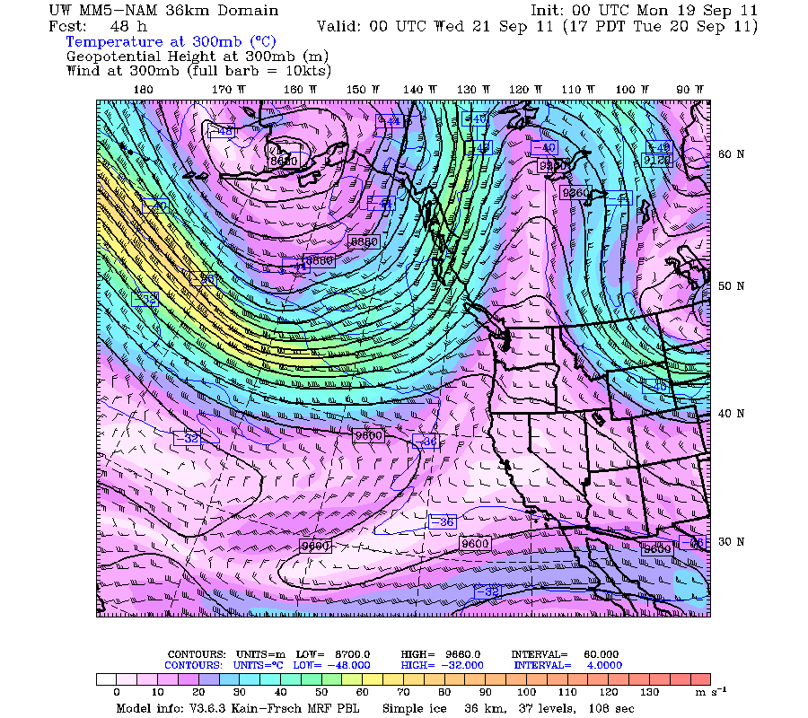
Valid 05:00 pm PDT Tue, 20 Sep 2011 - 48hr Fcst - UW 36km 00z MM5-NAM wind at 300mb
We will approach 70 with partly cloudy skies tomorrow, but the rest of the week will be in the mid 70s, with a slow warming trend throughout the week. Saturday will likely be the warmest day before clouds come in on Sunday. Also, that big potential storm I was talking about will pass to the north of our area but will still generate some cloud cover, so Thursday will likely be mostly cloudy. However, temperatures will still be in the mid 70s, around 5 degrees above average for this time of year. I don't think we will get to 80, but it is certainly possible, and looks more and more probable with each model run.
Thanks for reading!
Charlie
Great Job! Indian summer...lovin' it.
ReplyDeletethank you joe! is this joe richards? Indian summer is right :)
ReplyDelete