Friday, September 30, 2011

University of Washington Models, and Stormy Early Next Week?

Friday, September 30, 2011
6:06 P.M.


Now that I am an official UW student, I figure I might as well advertise the super-ultra-awesome mesoscale modes at the University of Washington Department of Atmospheric Sciences Website.

There are two main models that the University of Washington runs. These are the NAM (North American Mesoscale) and GFS (Global Forecast System). These are the most common models used by NOAA. What makes these models different is that they have extremely high resolution.

But what is resolution? I don't completely understand it... I've read Cliff's blog post on it but I still don't quite understand it. From what I've read, it seems to mean the difference in space between the points on a three-dimensional grid. There are forecasting models done in 3-dimensions, but something I have seen more often is a 2-dimensional grid that has no vertical component. Even though you would generally use x and y, it looks as though based on the picture below, you would use x and z and omit y, because y is the height component, while x and z are situated horizontally.

Again, you shouldn't take my word for this, I could be completely wrong, but hopefully I am not.

Three-dimensional resolution - Cliff Mass Weather Blog, "Resolution, " 9/14/11

Cliff Mass did a post on this, and used this exact picture. I will try to steer this blog post away from being a copy of his, but he talked directly about resolution, and that is what makes the UW models special. I don't want to get kicked out of college for plaigarism. If anybody reads this, and I am not citing enough credit, let me know. If this screws me over for college, I might as well join Delta House (John Belushi, anyone?). 


But in all seriousness, I'll show you the two basic models, plus different levels of resolution. Both the NAM and the GFS here use different mesoscale models to provide resolution. The NAM uses the MM5 (Penn. State/NCAR mesoscale model) and the GFS uses the WRF (Weather Research and Forecasting model).

The GFS, which is generally more accurate, has 36, 12, 4, and 4/3 km resolution runs, and the NAM has 36 and 12 km ones.

Let's take a look at the GFS!!!

Valid 02:00 pm PDT Fri, 30 Sep 2011 - 21hr Fcst - UW 36km 00z WRF-GFS 2-meter temp

Valid 02:00 pm PDT Fri, 30 Sep 2011 - 21hr Fcst - UW 12km 00z WRF-GFS 2-meter temp

Valid 02:00 pm PDT Fri, 30 Sep 2011 - 21hr Fcst - UW 4km 00z WRF-GFS 2-meter temp

Valid 02:00 pm PDT Fri, 30 Sep 2011 - 21hr Fcst - UW 4/3km 00z WRF-GFS 2-meter temp

All of these pictures are from the same time frame, which has already passed, but you can see the difference in resolution! Sorry about the 36km GFS, they only had that size (at least that I could find)

Now the NAM...

Valid 02:00 pm PDT Fri, 30 Sep 2011 - 21hr Fcst - UW 36km 00z MM5-NAM 2-meter temp

Valid 02:00 pm PDT Fri, 30 Sep 2011 - 21hr Fcst - UW 36km 00z MM5-NAM 2-meter temp

You get the idea. More resolution = more accurate forecasts. This will be especially useful for convergence zone events!!!

Now, let's look at next week... I'll have more details as it approaches, as the models aren't in perfect agreement, but we will see some moderate systems and there is a chance we could see a strong one. I wish I could give you more information, but doing so could be misleading. However, there could be strong winds on Tuesday as a surface low moves to our north. It looks to be weakening as it moves ashore, but if that changes, we could get pretty blustery.

Thanks for reading, I hope you learned something today!
Charlie

Thursday, September 29, 2011

Similar Forecast, and Variations in Temperature and Precipitation

Thursday, September 29, 2011
9:47 P.M.

There isn't much to talk about weatherwise... the models are still forecasting a warm day today with highs in the low to mid 70s and mostly sunny skies, with nice conditions Friday as well. We will see a weak system blow on through on Saturday, with cooler conditions Sunday. Next week looks cool and wet, but the models differ on details. I will let you know more as next week approaches.

One thing unique about the weather of Washington is that we can see vast variations in temperature and precipitation over short distances. Much of this has to do with our local topography. Places like Florida are essentially flat, and do not experience much variation with temperature or precipitation due to topography. Meanwhile, Washington has a moderating ocean, two major mountain ranges, an inland sea, rainforests averaging over 200 inches of rain each year, and then places like Sequim some 45 miles northeast, averaging 15 inches per year. If you want to get really dry, head over to the Tri-Cities.

 
One thing that has always fascinated me, though, is the differences in temperature right around the Seattle metropolitan area. Why is it that the coldest Seattle usually gets at night during an arctic outbreak is in the high teens, while suburbs may dip below 0?

The answer, of course, is the urban heat island. Although the picture below isn't the best example, it does the job. The heat island is generally most pronounced during arctic outbreaks in the winter at night, but it can be observed at any time of the year.


You can see warmer temperatures in places where there are buildings, and much cooler temperatures by the coast and across the sound/near Lake Sammamish. Downtown Seattle and the industrial sector east of the Duwamish are the hottest areas, with other cities and industrial areas being hot as well. Another pronounced site is Renton, where one of the Boeing factories resides.

I wish I could find a better picture during an arctic outbreak, but that will have to wait for another time. And I apologize if this post feels like it was written poorly, because I am trying to beat the clock to catch my atmospheric sciences class.

Thanks for reading!
Charlie

Wednesday, September 28, 2011

Nice for now, but Rain is on the way

Wednesday, September 28, 2011
5:09 P.M.


Today was my first day of college, and also my first day of Atmospheric Sciences 101. That's right, the legendary Clifford Mass taught me about meteorology. I learned some cool things, like what a Stevenson Screen is. If you want to find out what one is, you should take his class!

Anyway, let's talk about weather. Right now, the Camano Island radar is down for upgrades. It will get this "dual-polarization" upgrade that will help determine not only the amount of precipitation but the shape of it, helping meteorologists figure out what type of precipitation is falling. This will be very useful for future snowstorms in the Puget Sound region!

Today was a pretty nice day, but it will be even nicer tomorrow. Highs should rise up into the 70s in many locations, and mostly sunny skies will dominate. We will be a little cooler and cloudier on Friday, and we should see showery conditions on Saturday and Sunday.

 Early next week looks pretty darn wet. Right now, it looks as though we will see three systems right behind each other. We will see a moderate system come in Sunday night, but we will see a stronger one late Monday. On Tuesday, we will see showers, while Oregon and California will be bombarded by a strong front.

I have to go do some homework, college calls.
Charlie

Tuesday, September 27, 2011

Not Much to Talk About

Tuesday, September 27, 2011
12:29 P.M.


Not much to talk about today... there is an unstable air mass over the area, although most of the activity is over Vancouver Island. There may be an isolated thunderstorm over northern Washington.

The atmosphere will stabilize over the next couple days, and Thursday in particular will be a fantastic day to get outside! Highs will reach the lower 70s with mostly sunny skies.

We will see a moderate system come in on Friday, but nothing to really worry about... and the weekend will be nice.

I am monitoring a potential major system early next week, although it isn't too bad in the models right now as they stall and weaken it off of our coast. If this changes, I will let you know.

Thanks for reading!
Charlie

Monday, September 26, 2011

Storm Today, and then Seasonable Weather

September 26, 2011
1:53 P.M.

Just a quick note today... the storm we had today had remnants of tropical moisture, which is why it has been so wet! In fact, some places in the Olympics have had over 3 inches already, and they will continue to pick up more.

Looking into the future, it looks like we will have seasonable weather for this time of year. We will see mostly cloudy skies with sunbreaks at times, and no major systems will come through. The mountains, however, will see lots of showers, particularly the Cascades, and most of this action will be on Tuesday. This is because there is a strong jet perpendicularly aimed right at them, causing air from the surface to rise and condense, forming clouds and precipitation. The below picture shows the jet stream over our area Tuesday night.

 Valid 08:00 pm PDT Tue, 27 Sep 2011 - 39hr Fcst - UW 36km 12z WRF-GFS 300mb winds


We will see some showers on Friday and Saturday as a weak system pushes through the area, but nothing to be concerned about. We could have a strong system next week... we will see

Thanks for reading,
Charlie

Saturday, September 24, 2011

Morning Update

Saturday, September 24, 2011
9:47 A.M.

This will be quick... I have people to meet and places to go! UW game at 12:30 by the way, go Huskies!

Anyway, today will be warm and humid* as we have that warm southerly flow. We could see those thunderstorms in the Cascades, although it looks like we will see them in the early morning hours of Sunday, though some storms are possible later today.

The below graphic shows 3-hour precipitation amounts - you can see precipitation not associated with the oncoming front over the Cascades, particularly the eastern foothills. Click on it to enlarge the picture.

Valid 02:00 am PDT Sun, 25 Sep 2011 - 21hr Fcst - UW 12km 12z WRF-GFS 3-hour precipitation

The Monday storm looks different again... precipitation amounts vary widely over different parts of the lowlands. I'll let you know more info as the the date moves closer. There will be a noticeable change in the weather tomorrow, with steady rain at times and mostly cloudy conditions, but the real stuff will come in on Monday. One thing is sure; Monday will be very cool relative to what we have had lately - highs will struggle to reach the low 60s. 

Go Huskies!
Charlie

*Seattle doesn't actually get that humid

Friday, September 23, 2011

Weekend and Next Week

Friday, September 23, 2011
7:16 P.M.

Hi everybody. As expected, the forecast for Monday has changed... again. I'm going to refrain from posting too much detail about it as it will probably change again. The models usually have a pretty hard time during the fall!

Meanwhile, we had a nice warm day today. I said in an earlier post that we would not have an 80 degree day until spring next year. I was wrong. We got up to 80 degrees in Seattle, I'm not sure about the airport, but it could have been warmer. I guess it could have been colder too, though.

Saturday will also feature warm temperatures, and I think we will get up to 80 degrees again. However, it will feel even warmer than that because we will also be fairly humid. This won't be anything like east coast humidity, but it will feel a little sticky tomorrow. This is because we will have a southerly flow, as opposed to the typical drying, easterly flow that we typically associate with heat waves.

The graphic below shows the temperatures predicted at 5 P.M. tomorrow. You can see mostly high 70s throughout the area with warmer temperatures in eastern Washington and cooler temperatures closer to the coast.

 Valid 05:00 pm PDT Sat, 24 Sep 2011 - 36hr Fcst - UW 4/3km 12z WRF-GFS surface temperature

One note - we could see a few isolated thunderstorms in the Cascades late tomorrow. This often happens when we have a southerly flow in the summer/fall.

College calls, thanks for reading!
Charlie

Monday Storm

Friday, September 23, 2011
12:10 A.M.

Hi everybody, I just moved into my dorm today. The weather system coming in for next Monday looks significantly different in the models from what it looked just a day ago. Whereas the models before showed a large front sitting over the area and giving us heavy rain, the new models show a front that would likely give us less rain but has the potential for fairly breezy conditions. There definitely isn't anything to be worried about, and these winds will not cause damage unless the forecast changes drastically. However, locations on the north Washington coast could get fairly windy, with the windiest conditions likely being around Tattoosh Island.

Overall, this new storm is weaker. The earlier forecasts showed the Olympics getting pounded with over 6 inches of rain in spots, with the potential for up to 10 inches in isolated, orographically-favored locations. Now, they'll be lucky to get three inches. Seattle was forecast to receive over an inch, and now we'll be lucky if we see a half inch.

But take a look at some of the winds...

Valid 08:00 am PDT Mon, 26 Sep 2011 - 87hr Fcst - UW 12km 00z WRF-GFS 10-meter winds

You can see some high winds near the coast. Puget Sound will not have high winds. If this storm was further south, we could have some action.

This is a radically different system than was forecast a day ago, and it is common for forecasts to be inconsistent this time of the year. Often, tropical moisture gets imbedded in the westerlies, and that has proven to be a challenge for the models. The forecast will probably change again, though it has become more consistent lately.

It's late! Time to go to bed.
Charlie

Wednesday, September 21, 2011

The Coastal Radar is Up!

September 21, 2011
10:44 P.M.

11:59 pm PST Sun 02 Dec 2007 Radar Image

The above picture was taken around midnight on Monday, December 3, 2007. I remember the day of this storm because it was one of the strongest storms I have ever seen in my life. This storm has since been known as the "Great Coastal Gale" of 2007. I think the word "gale" is a little too light... there were sustained hurricane-force winds on the coast and even higher gusts, with widespread gusts of 100 mph and gusts approaching 140 mph in many coastal places. And the rainfall was extraordinary. Bremerton, just west of downtown Seattle, received 10.78 inches of rain in 24 hours. Even more rain fell in the Olympics and Willapa Hills. Cushman Dam by Hood Canal picked up 17.4 inches of rain from the storm, while Rock Creek, a Weyerhauser site in the Willapa Hills, picked up 19.63 inches. Needless to say, it was an extraordinary event. More information can be found at a Forests and Fish website here, or at the Office of the Washington State Climatologist (OWXC) website here, under "The Great Coastal Gale of December 1-3, 2007." the Forests and Fish one talks more about rainfall, while the OWSC one talks more about wind. Both are great resources.

One thing that was significant about this event was that it showed the need for a coastal radar.This storm killed at least 13 people in Washington and Oregon. It is widely believed that those people could have survived if we had a coastal radar. If we had one back then, we could be able to give out advance warnings on the exact timing of the winds and intensity of the precipitation. Unfortunately, much of the middle coast was completely blocked, and detailed warnings could not be given.

After this storm, people realized the need, and Senator Maria Cantwell received funding for it. Go Maria Cantwell! 

Take a look at some radar pictures from today. Although we didn't see any rain, there has been a strong front offshore that has been giving rain to Vancouver Island. Take a look at the Camano Island radar below...

03:23 pm PDT Wed 21 Sep 2011

... and now the Langley Hill radar...

03:23 pm PDT Wed 21 Sep 2011

These pictures are very exciting to see! I'm ecstatic. I thought I'd miss the old "V," it had some sentimental value to me. Now, I don't miss it one bit. 

Thanks for reading you guys, I start Atmospheric Sciences 101 in one week! 
Charlie

Updated Forecast, Heavy Rain on Monday?

Tuesday, September 21, 2011
1:08 P.M.

I'm writing this from the Seattle Public Library since I am not at home right now. I'm actually waiting for ID from the Department of Licensing downtown, which will take a while.

Anyway, the models have not changed their thinking much today. That big storm from that powerful wave I was talking about is still heading up north to Alaska. However, the models have eased off on what little rain there was in Seattle. There will be some afternoon light rain far north, but we may escape without seeing any measurable rain in Seattle. There is a chance for some rain, but if there is any, it will either be just a trace or a few hundredths of an inch. Nothing to worry about.

Of course, we will still see some additional cloud cover, and this will keep our temperatures from getting too hot today and tomorrow. Temperatures could actually get fairly mild today, as that big storm is bringing up a lot of air from the south, but Thursday will be cooler. Once this storm passes through, Friday and Saturday will be nice! I don't think we will get into the 80s but we should be mostly sunny both days.

Clouds ahead of the next system come in on Sunday, and we should see some rain, particularly in the afternoon. This system will be pretty weak though.

I was particularly looking at the Monday system, because it looks like it could give us a fairly heavy dosage of rain for this time of the year. Take a look at the picture below, it shows 3-hour precipitation and gives a loose approximation of what the storm might look like.

Valid 08:00 am PDT Mon, 26 Sep 2011 - 123hr Fcst - UW 36km 12z WRF-GFS 3-Hour Precipitation


It definitely looks like a pretty large storm from here! And the 24-hour precipitation amounts ending at 5 A.M. on Tuesday are impressive as well.

Valid 05:00 am PDT Tue, 27 Sep 2011 - 144hr Fcst - UW 12km 12z WRF-GFS 24-Hour Precipitation


That is some heavy rain for this time of year! Compared to last night's 00z run, the rain in the Olympics is a little lighter (though still significant), while the rain in the Cascades and lowlands is heavier. The eastern valleys of the Cascades will receive very little precipitation from this storm. This is because the mid level winds (850 millibars) are fairly fast, thus promoting orographic effects. This means that mountains will see more precipitation, and places behind the mountains (like Eastern Washington or Sequim) will see very little rain.
 
Valid 11:00 am PDT Mon, 26 Sep 2011 - 126hr Fcst - UW 12km 12z WRF-GFS 850mb temp, winds, heights
 
I realize that above map is hard to read, but you can see that tight pressure gradient and those barbs pointing from a southwesterly direction. Those barbs translate into the winds at that level. I forget the actual system of finding out how much wind those barbs mean, but I generally go by the ground rule that barbs with more stuff on them translate to higher winds. Regardless, there is a tight pressure gradient, and that definitely shows that there will be strong winds aloft.
 
Bottom line: look out for Monday, as we could see some hefty rain totals for this time of the year. Beyond that, we will be drier, but it will start to feel like fall and we will not be quite as warm. In the meantime, enjoy some nice sun and warm temperatures!
 
Thanks for reading,
Charlie

Tuesday, September 20, 2011

Mostly Dry This Week, Wet Next Week, and Watermelons

Tuesday, September 20, 2011
6:57 P.M.

Painting or time-lapse photo?

Autumn officially begins 2:05 A.M. PDT Friday, September 23, but we'll still have some nice weather for the next week or so. Looking at the models and National Weather Service discussions today, it seems as though we won't be quite as sunny as we previously thought on Wednesday and Thursday. Some of those powerful waves that I was talking about will scrape us with a few clouds and maybe some rain, but it looks like the effects from these will be minor compared our storm this past weekend. The storms themselves will be very powerful, particularly the one slated for Thursday, but they will make landfall in the Alaskan panhandle.

Valid 05:00 am PDT Fri, 23 Sep 2011 - 60hr Fcst - UW 36km 00z WRF-GFS 3-Hour Precipitation

As the model above shows, Vancouver Island will get swamped mid-week, but we should remain fairly dry with only a few periods of light rain, with more the further north you go. On the flipside, these storms will create some dents in the ridge of high pressure protecting us. I guess you can think of this ridge of high pressure as a big watermelon. These storms can be thought of hammers hitting the watermelon. Most of them will bruise the watermelon, but when the watermelon has been bruised enough or a massive storm comes in, the watermelon will break open, leaving the untamed hammers to pound the innocent populace of the Pacific Northwest.

Poor watermelon :(

While we will have nice weather Friday and Saturday, we will suffer another bruise to our dome of high pressure on Sunday. And on Monday, our watermelon will finally burst, and we will see sizable amounts of precipitation in the area. See below.

Valid 05:00 pm PDT Tue, 27 Sep 2011 - 168hr Fcst - UW 12km 00z WRF-GFS 24-Hour Precipitation

At this point, it looks like the lowlands could receive up to an inch from this storm. It looks like some isolated spots in the Olympics could receive over 6 inches of rain, but 3-5 inches will be more common.

After that, it looks like we will regain some sunshine, but highs will be in the upper 60s, which is normal for this time of year. We won't be getting a new watermelon anytime soon, but somebody might help stitch it up.

Thanks for reading :)
Charlie

Monday, September 19, 2011

Green Flash

September 19, 2011
3:39 P.M.

"It was the best green flash I've ever seen" - Mila Zinkova, Santa Cruz, CA, January 29, 2006


I've written two entries on interesting phenomena that I've seen this summer. I have seen Kelvin-Helmholtz waves and a massive superior mirage, and you can see my posts on those. This year, I saw another interesting atmospheric phenomenon - the "green flash." It is subtle, and if you aren't specifically looking for it, it can be hard to see, but it is very interesting when you do see it.

If you see a green flash, there is no need to duck for cover; Lord Voldemort isn't trying to kill you. A green flash is a very rare sliver of green light most usually seen right after sunset or before sunrise.

Let's use a setting sun as an example, as green flashes are most commonly seen at sunset. Green flashes occur because light is refracted as enters the atmosphere. Light moves more slowly in the denser air nearer the ground than the thinner air aloft. Out of all the colors in the visible spectrum, infrared (the color) has the longest wavelength, and ultraviolet (once again, the color, not the separate type of  wave) has the shortest. Shorter wavelengths follow closer to the curvature of the Earth when the sun is right at the horizon. Therefore, as the sun sets, the longer wavelengths (first red, then orange, then yellow) disappear because they don't follow the curvature as closely as the shorter wavelengths (green, blue, violet) and therefore travel faster since they are higher up, where the air is thinner. Green, meanwhile, stays in the lower atmosphere and travels slower, so green is the last color we see, with it being more yellowish at first and more blueish at the very end before it dies out.

Why don't we get blue or violet flashes then? These types of light are generally scattered throughout the atmosphere as the sun sets. Otherwise, we'd see violet flashes. On very rare occasions, however, you can see a blue flash, especially if the air near the surface is very dense and the air aloft is much lighter (like an inversion).

There are four types of green flashes. These are the inferior-mirage, the mock-mirage, the sub-duct, and the green ray. The inferior and mock-mirage flashes are by far the most common, making up 99% of all green flashes, with the inferior being the commoner one. I saw an inferior green flash, and the picture at the top is an inferior green flash as well.

Inferior-mirage green flash looking west from Madagascar - Vic and Jen Winter, 2001

Inferior green flashes are formed when the air at the surface is warmer than the air above. They are best seen at sea level.

Mock-mirage green flash - Mila Zinkova, San Francisco, CA, September 17, 2006

Mock-mirage green flashes are formed when the air at the surface is colder than the air above. They are best seen above sea level.

Sub-duct green flash - Andrew T. Young

First of all, a duct is a horizontal layer within the atmosphere that traps various types of waves below it. I've seen these before; in fact, the picture below shows a duct (from the superior mirage i saw earlier this summer). That top of the "fog bank" is the duct, and although it isn't perfectly lined up, you can see how the "boat" flattens out just before that.


Sub-duct flashes are very rare and are incredible. They last for around 15 seconds as opposed to the second or two you see inferior-mirage green flash for. I'd suggest checking out this link. Incredible pictures of the whole process, including a violet flash at the very end! Highly, highly recommended. If I was a teacher, I'd require everybody to look at this page, so go ahead a take a peak.

 Green ray (I think) - Guillaume Dargaud, Dome C, Antarctica, March 2004 (58C below 0!)

It is hard to find pictures of green rays because they are so rare and "green flash" and "green ray" are often used interchangeably, even though the "green ray" is a specific time of green flash. This is the best picture I could find.

And finally, a video of a standard inferior-mirage green flash.


Three hours later, I'm done and knowledgeable about green flashes! I can't do super long posts when school starts, but I'll still be up on the blog. I move in on the 22nd and start classes on the 28th. UW baby!

Thank you SO MUCH for reading my blog!!! I really appreciate it.
Charlie

Sunday, September 18, 2011

Getting warmer next week!

Sunday, September 18, 2011
8:30 P.M.

Summer is back!

Hi everybody! I have some good news for you sun lovers. It looks like we have a warm week on tap. Remember that powerful wave I was talking about? As expected, the situation changed, and now it is heading north of us as a strong upper level ridge builds over the area. This will give us one last stretch of warm temperatures and mostly sunny skies. 
Take a look at the model below...

Valid 11:00 am PDT Mon, 19 Sep 2011 - 18hr Fcst - UW 36km 00z MM5-NAM 1000-500mb thickness

You can see a large low spinning in the Gulf of Alaska. However, you can also see that it is bring warm air up from the eastern Pacific and cool air down from Alaska on the western side of the storm. It almost looks like a yin-yang sign. Anyway, what this low pressure system is doing is actually creating a ridge of high pressure east of it. You can clearly see the ridge in the upper atmosphere, marked by those blue lines. 
The saying "the calm before the storm" actually holds some truth, because while air is rising at the storm's center, air is sinking ahead of it, creating fewer clouds and higher precipitation. When the Pacific Northwest is continually getting battered by storms during the winter, the driest periods are often before major systems that come in because there are weak ridges of high pressure in front of them.

A few frames later, you can really see the ridge building over the Pacific Northwest, stretching all the way up into northern Canada.

Valid 05:00 pm PDT Tue, 20 Sep 2011 - 48hr Fcst - UW 36km 00z MM5-NAM 1000-500mb thickness

With the deep low pressure continually bringing up warm air from the south and forming an upper level ridge, the Pacific Northwest will experience few clouds over the next week and sunny temperatures.
A frame of the jet stream from the same time clearly shows the ridge as well.


Valid 05:00 pm PDT Tue, 20 Sep 2011 - 48hr Fcst - UW 36km 00z MM5-NAM wind at 300mb

We will approach 70 with partly cloudy skies tomorrow, but the rest of the week will be in the mid 70s, with a slow warming trend throughout the week. Saturday will likely be the warmest day before clouds come in on Sunday. Also, that big potential storm I was talking about will pass to the north of our area but will still generate some cloud cover, so Thursday will likely be mostly cloudy. However, temperatures will still be in the mid 70s, around 5 degrees above average for this time of year. I don't think we will get to 80, but it is certainly possible, and looks more and more probable with each model run.

Thanks for reading!
Charlie

Saturday, September 17, 2011

Storm Update

Saturday, September 17, 2011 7:30 P.M.

It looks as if the rain has spread in much earlier than I anticipated, so I am shifting rain totals higher amounts (up to a half inch in the lowlands) and am expecting the rain to stop and shift to showers Sunday morning. I guess the model I looked at did not have a good grip on this storm! I guess I'll have to get used to that too... another part of winter in the Pacific Northwest.

Charlie

First "major" storm of the year

Saturday, September 17, 2011
10:56 A.M.

9/17/11 10:45 A.M. PDT infrared satellite (taken from UW atmos website)

Ladies and gentlemen, it appears that our first "major" storm of the year is upon us. I say "major" because it will likely be the biggest storm we have seen in months. However, I put quotes around it because in all honesty, it is a pretty weak storm. However, remember how I was talking about that pattern change and that strong jet stream? Although most of the storm is heading up north, the jet stream has helped the cyclone deepen, and we will see some fringe effects of it.

One thing that stands out is that you can see three clear fronts. The cold front is in the far left, and it is trailing the storm. The warm front is to the far right, and it is already spreading some clouds over the area. The occluded front is to the north, and it is bent back in a counter-clockwise direction to the center of the low. For more information on the different types of fronts, refer to my previous blog post.

 Valid 11:00 am PDT Sat, 17 Sep 2011 - UW 12z  36km WRF-GFS 3 hour precipitation

The above model frame, taken from the WRF-GFS model in 36km resolution, shows the current precipitation associated with this storm, as well as the isobars. Isobars show lines of constant pressure, and can be thought of as a "topographical map" of pressure at the surface.

Valid 05:00 am PDT Sun, 18 Sep 2011 - UW 36km 12z WRF-GFS 3 hour precipitation

We are getting drizzle right now, but the storm will really start to affect the interior early Sunday morning. The Olympics will get the heaviest rain, but the lowlands will likely also get some significant rain for this time of year. Nothing too drastic, but more than we have seen in a while. I'm forecasting amounts up to 1.5 inches on the Olympics with most places getting less, and rainfall amounts around a quarter of an inch or less in the lowlands, with more precipitation the further north you go.

I was looking at the extended run of the WRF-GFS, and I saw something that could be a little troublesome.

Valid 11:00 am PDT Wed, 21 Sep 2011 - 102hr Fcst - UW 36km 12z WRF-GFS 3 hour precipitation

 My eye immediately jumped not to the storm affecting British Columbia and Alaska (which is significantly stronger than tomorrow's storm but will not impact us) but to the wave by 40 degrees north and 160 degrees west. After watching these models for years, I've become able to recognize waves that look like they might have potential to develop into strong storms. 

Below is the same wave 15 hours later.

Valid 02:00 am PDT Thu, 22 Sep 2011 - 117hr Fcst - UW 36km 12z WRF-GFS 3 hour precipitation

But look at the storm it develops into 18 hours later!

Valid 08:00 pm PDT Thu, 22 Sep 2011 - 135hr Fcst - UW 36km 12z WRF-GFS 3 hour precipitation

That is a very powerful storm for September! A little further south and we would be talking about a major windstorm. And when I say major this time, I really mean it.
But I started to get concerned after the following frames. Here is the storm 12 hours later.

Valid 08:00 am PDT Fri, 23 Sep 2011 - 147hr Fcst - UW 36km 12z WRF-GFS 3 hour precipitation

You can the cold front "training" into the Olympic Mountains. This setup is called a "Pineapple Express," because it often stretches back toward Hawaii and brings gobs of saturated, subtropical air into our area. To make matters worse, these types of storms often stall over the area and don't move from side to side much. This is a classic setup for major flooding in the Pacific Northwest. Right now, the front is mainly to our north and only dips down for a small period of time, which would give the mountains heavy rain but would confine Vancouver Island to flooding. Also, this forecast is far in advance.

Bottom line: this scenario is too far out to make any conclusions, and honestly, it probably will not develop. But it is something to keep an eye out for. I have already warned my cousins who live on the Snoqualmie River, because if this scenario plays out and the front stalls over central Washington, some of our rivers could flood. 

Regardless, it is interesting to see a storm this powerful this early in the season. Then again, the most powerful windstorm on record, the Columbus Day Storm, was also the earliest major windstorm, striking the Pacific Northwest on October 12, 1962. 

The storm season is upon us!
Charlie

Friday, September 16, 2011

Tropical vs. Extratropical Cyclones

Thursday, September 15, 2011
4:05 P.M.

I'm doing what would be Friday's post today since I will hiking around Mt. Rainier tomorrow.

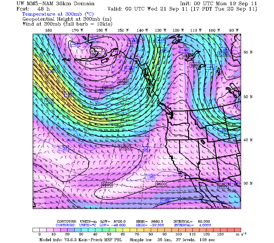
We are now right at or just past the peak of hurricane season, and in a month or so, we should start seeing a more consistent flow of extratropical storms across the Pacific, and they will really ramp up in November. Hurricanes and extratropical cyclones may seem similar at face value; they both cause rain and wind. However, that's about where the similarities end. The more I have learned about these two types of storms over the years, the more I have marveled about how two completely different sets of circumstances can produce extremely powerful storms.

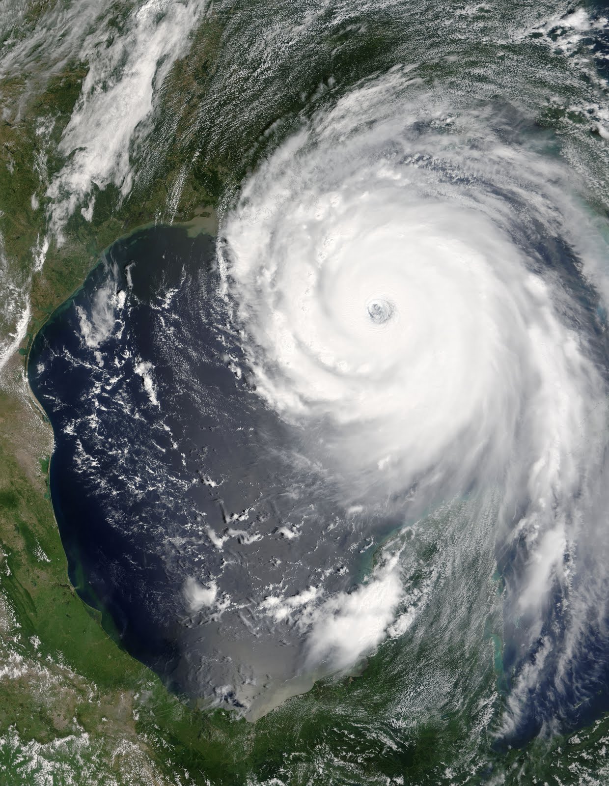
Hurricane Katrina, 8/28/05. Author: Jeff Schmaltz, MODIS Rapid Response Team, NASA/GSFC

Hurricanes derive their energy from heat and moisture. There are three main ingredients needed for tropical storm formation: warm SSTs over 80 degrees Fahrenheit, ample moisture, and an area of convergence. Most of the tropical cyclones in the Atlantic start out as thunderstorms in the Intertropical Convergence Zone (ITCZ). The ITCZ, known by sailors as the Doldrums, is the area where the trade winds from the northern and southern hemispheres meet. If a sailor wandered too close to the equator, they often got stuck in the Doldrums. The Doldrums are hot, humid, and calm. Many sailors who got stuck in the Doldrums ended up starving because they could not get catch any wind. Crossing the equator was a risky move for sailors and explorers, and not everybody made it.

The warm SSTs, the hot/humid air, and the low wind shear in all levels of the atmosphere make the ITCZ a prime spot for tropical cyclone formation. When enough thunderstorms develop, a local area of low pressure is formed from the convection that the storms produce. Winds rush to the area of lower pressure and rise, creating more thunderstorms, more convection, and even lower pressure, as more air rises upward from the center rather than filling it in. Additionally, when water turns from invisible water vapor gas to visible cloud droplets, latent heat is released because of condensation, which gives the storm even more energy. If conditions are favorable, this cycle strengthens and a tropical storm (sustained winds 39-73 mph) is born. At some point, the Coriolis Effect, which causes things to deflect to the right, becomes more noticeable, and a center of circulation develops. If the storm continues to strengthen, it will become a hurricane and the center of circulation will be clearly visible. This is called the "eye" of the storm. Even though the eye is where the lowest pressures are found, the winds are calm and there are often sunny skies. Remember, winds are created by differences in air pressure, not simply low pressure itself.

As long as a hurricane has warm water, humid air, and low wind shear, it will generally keep its strength or strengthen. Some hurricanes can last for weeks. A hurricane will die out when wind shear rips it apart, when it runs into dry air, or when the energy source (warm water) is cut off. That is why hurricanes die out so quickly when they reach land. They no longer have access to the warm water that gives them energy.

As you can see from the picture of Hurricane Katrina above, strong hurricanes are very symmetrical, especially when there is low wind shear in the upper atmosphere. The eye wall surrounds the eye, and this is where the heaviest rain and strongest winds are found. Out from that, higher rain clouds give moderate amounts of precipitation, with heavy amounts of precipitation found in individual rain bands. Tropical systems can generate enormous amounts of rain. In fact, Alvin, Texas, received 43 inches of rain in 24 hours when Tropical Storm Claudette stalled over the region, setting a U.S. record that has yet to be broken.

The below diagrams show the formation of the thunderstorms required for tropical systems and the basic anatomy of a hurricane. I got both of these from an MIT page.

Storm formation

Hurricane anatomy

Now, I'll talk about extratropical cyclones.

Infrared Satellite picture 12/14/06 @ 6 P.M. PST, courtesy of US Naval Research Labortory

The above photo is an infrared satellite picture of the Hanukkah Eve Storm of 2006, the most recent major windstorm to affect Seattle and places east of the Washington and Oregon coasts. This storm was the most powerful one since the Inauguration Day Storm of 1993, and the most damaging since the Columbus Day Storm of 1962. For more information on this storm, ask me or check out The Storm King website under "My Favorite Weather Links" on the right side of this blog.

While tropical cyclones get energy from a homogenous, hot, and humid air mass, extratropical storms get their energy from a boundary, or front, between two different air masses. There are three main stages that extratropical cyclones go through.


The first stage is what is called an open wave. A storm starts off with a stationary front dividing warm air from the south and cold air from the north. Because of the Coriolis Effect, cold air will push south and warm air will push north, creating a center of rotation with fronts that spin counter-clockwise in the Northern Hemisphere, and clockwise in the Southern Hemisphere.

The second stage is a fully developed cyclone. The counter-clockwise rotation that began with the open wave strengthens and the pressure begins to drop. Also, since cold fronts tend to move faster than warm fronts, the storm takes on less of a horizontal appearance and begins to make the familiar common shape that we often see with these types of storms. As warm air from the south is sucked into the center of the storm, it rises, expands, condenses, and cools, while releasing latent heat from the condensation of water droplets in the process. At this stage of the cyclone, there is more air being sucked up than air filling the low pressure center at the surface. Because of this process, additional air molecules are being expelled, creating lower atmospheric pressure throughout the mid and lower levels of the storm.

The third stage is the occluded cyclone. Remember how I said that cold fronts move faster than warm fronts? Eventually, the cold front catches up and overtakes the warm front. This creates a new type of front - an occluded front. Occluded fronts share the characteristics of both warm and cold fronts. This is most intense stage of the cyclone, but sometime into this stage, the cyclone begins to weaken. This is because the air masses on either side of the occluded front are similar in temperature and humidity, and since extratropical storms get their energy from different air masses along a front, they are cut off from their energy source and slowly weaken.

A storm can get especially strong when it is fed by a strong jet stream. Strong jet streams often form amongst stark differences in tropical and polar air masses, meaning that there is a lot of potential energy stored. As previously stated, cyclones deepen when warm air rises into colder air, with more air rising from the center than rushing to it. Additionally, a strong jet stream will speed up this process. Warm air will converge at the center at a faster rate, and the cooled air aloft will diverge faster, making way for new air to fill the void.

The result can be a huge storm with winds that can sometimes approach category 3 hurricane speeds. In addition, these storms are much, much larger and usually move much faster. The Columbus Day Storm of 1962 created hurricane-force winds from California to Vancouver Island, and some storms have stretched from the Pacific Northwest all the way to the International Date Line!

As you can see, these two types of storms are very different! There are a lot of minor details, particularly with extratropical storm formation, which is considerably more complex than tropical storm formation (at least it's harder for me to explain). Upper level winds fuel a mid-latitude cyclone but can tear a tropical one apart. Extratropical storms usually disintegrate after a couple days due to an occlusion, but tropical storms can exist for a much longer time. And the biggest difference of course, is that tropical cyclones have no fronts. They get their energy from warm air. Extratropical cyclones start because two air masses come together and form a front.

That was a really long post, if you have any questions, comment below and I will be sure to answer them.
Thank you for reading!
Charlie

Thursday, September 15, 2011

Double-Dip La Nina!

Thursday, September 15, 2011
10:08 A.M.

 Sea Surface Temperatures at different points in the Equatorial Pacific on week centered around 9/7/11

The above picture is from NOAA's CPC (Climate Prediction Center). As you can see, there has been a clear trend as of late for a cooling of the SST (Sea Surface Temperatures) in the Equatorial Pacific. This trend is also reflected at deeper depths. Last year, we saw one of the largest La Nina events on record, but we transitioned to a neutral pattern after that. However, around August, there was a strengthening of the trade winds, resulting in increased upwelling in the Eastern Tropical Pacific. When you have upwelling, you have cooler SSTs because the water at the surface is being continually replaced by deeper, cooler water. That is why the the water off of Los Angeles is generally 20-30 degrees cooler than the water in the Gulf of Mexico in the summer. Upwelling is strongest closer to shore, so when I go tuna fishing off of the Washington coast, I have to go around 50 miles out to get to warmer, bluer water, as upwelling also increases nutrients toward the surface. In fact, the ancient Peruvians knew an El Nino was coming when the fishing off of their coast became poor. There was a decrease in upwelling, resulting in less nutrients and less fish. 

But enough about fishing. Let's talk about weather. If you take a look below, you will see a bunch of models showing their predicted SST anomalies for the Nino 3.4 region, which is usually regarded as the most reliable region for telling if a El Nino/La Nina event is forecast or occurring.

Dynamical and Statistical 3.4 SST anomalies from the International Research Institute for Climate and Society Updated 8/17/11

I looked all over for a more present chart, but this is all I could find, and I took it off of Cliff Mass' blog. Thanks Professor Mass!

As you can see, the models are all over the place. However, the NCEP CFS model clearly shows La Nina conditions, and this model is generally regarded as the most accurate.

The models, along with decreasing SSTs and a historical tendency for weaker La Ninas to follow major events, have prompted NOAA to raise their previous La Nina Watch to a La Nina Advisory. Basically, this means that they are now forecasting La Nina conditions for the coming winter, whereas before they were uncertain.

Most of you know what a La Nina means for us; we will have cooler than average temperatures and above average precipitation this year, most pronounced after January 2012. We will also have a higher probability of above average snowfall in the mountains and in the lowlands. I don't know if they have snow days in college, but I'm hoping they do. And for those still in grade school, you may get an unexpected day off or two this winter.

For current La Nina conditions, check out the "Tropical Pacific SST" link I have on the right side of this blog. Or, you can go here: http://www.cpc.ncep.noaa.gov/products/analysis_monitoring/enso_update/sstanim.shtml

You stay classy, planet Earth.
Charlie