Thursday, November 25, 2010

A Little Bit Of Light Snow This Morning, Then Changing To Rain

Thursday, November 25, 2010
8:59 A.M.

Hey ya'll, so we are seeing a little bit of light snow this morning. It's not that big of a deal because it is going to change to rain later in the afternoon and it will melt. I suspect some roads will still be slushy (especially sidestreets) but as time goes on we will warm up enough that that slush won't last too long either. I've gotten less than an inch so far at my house, and most other places will receive the same amount of snow before it changes to rain, save the hills and up north in Bellingham where you could see up to 2 and 3 inches respectively. A WINTER WEATHER ADVISORY is in place for all of Western Washington except the Cascades, where a WINTER STORM WARNING is in place for a foot of snow.

Other than that, there isn't too much to talk about. The DOT handled the roads nicely with salt, which of course, I didn't really like, but it was ok because I got school off anyways. Salt kills engines and the environment, but it works. Still, I like seeing the arterials white with snow. I went skiing down some back in 2008. THAT was fun.

We will be gradually warming up to "balmy" temperatures in the mid 40s with showers most of the time, except some drying during the weekend. No big storms look to be headed our way.

However, there could be another arctic outbreak on the horizon. It looks very unlikely at this point, but some models have been showing some arctic air spilling down. Right now, it is much too far to our east. We will see if we get some more Fraser River outflow. This would be in approximately one week. I'll keep you posted. LAWES level 1.
But it heads off much further east later. Still, an impressive arctic high!

Of course, the mountains are looking good for snow. Here's the Alpental base...
And here's Snoqualmie Pass...

So the lowlands are done with snow for a while, but the mountains will get some, and there is a possibility, albeit slim, that we could return to colder weather next week. Have a great day and give thanks for the snow we did have. :)

0:26 minutes

Tuesday, November 23, 2010

Visibility

Ok, visibility kinda sucks, at least right now. It may change. I'm not sure why. Maybe because the snow is giving off some moisture, maybe because there is more particulate matter. But it will get better throughout the day today. I might talk with Scott Sistek more about this. For those of you who don't know Scott, he's the man. Find him on "Scott Sistek Weather" on facebook. In addition to his insights, me and a bunch of weather nerds always post stuff on his wall. It's a really cool community, and those who are excited about weather should check it out.

Midnight Update

Monday, November 22, 2010
11:50 P.M.

So the snow has now largely come to an end. Don't be surprised if you see a flurry, but I doubt you will see any additional accumulation.

Generally, I've been hearing of about 5 inches of snow in the Seattle area. I have 5 inches at least. Very, VERY cool stuff. I'm pretty darn happy right now. And the mountains are getting tons too.

This has been pretty crazy. This much snow this early. Let's hope that it is a precursor of things to come. I think I already said this too, but Barrow, Alaska was warmer than Seattle today.

The big stories now are going to be cold and wind. First, let's look at some temperatures. This model below shows the 7:00 A.M. (generally coldest part of morning this time of year) temperatures for Tuesday morning. Seattle will likely get down to 20 degrees or so. Even areas near the water will still be below freezing.

By the way, tomorrow will feature SPECTACULAR visibility. The atmosphere is very dry, there is little air pollution, and it will be completely sunny. There will be a marked difference. When you don't have humidity or particulate matter clogging up the atmosphere, you can see a lot further. That is why deserts (except when they have dust storms) are often very good for viewing stars - very low humidities.

The day after tomorrow (haha) will be even colder. Here is the same chart 21 hours later (the morning low will occur earlier because the sun will be out).
Even colder for Seattle! You can already see warming off the coast - that is part of the high pressure that gave Barrow a high of 34 today coming in. Yeah, it's that big of a high pressure ridge. But in Seattle, lows will get into the mid teens. Outlying locations could get to 0 degrees.

This graphic shows how dry the air mass is by measuring the RELATIVE HUMIDITY of the atmosphere. It is for mid-morning tomorrow. See that orange around us? It means we have a relative humidity of 25 %. That is extraordinarily dry. And colder air masses hold less moisture (90 degrees 100% relative humidity is much more humid than 50 degrees 100% rh) so a subfreezing air mass with a relative humidity of 25 % is extremely dry.
Haven't shown the relative humidity graphic before. It's a cool one. :)

Now - winds! The saga never ends. The winds are blowing like crazy up north right now, as this graphic shows. This shows what was forecasted for 10 P.M., so it is actually an old graphic, but that is when the winds peaked and this is how fast they were. Note - these are SUSTAINED winds. Multiply by 1.5 to get gusts (approximation).
You can see a very localized, but intense, area of winds up north.

These winds will weaken, but winds will spread throughout Puget Sound Tuesday as this graphic indicates.
It will be cold and windy, especially in the sound. This graphic doesn't show Seattle getting real strong winds, but all you need to do is shift the gradient a little, so I would still be on the lookout for some gusts tomorrow. Places over water, however, will take the main beating. These winds, however, will be nowhere near as strong as the ones being witnessed right now over the San Juans. A high wind warning is in effect for those areas right now. Winds over most of the sound look to be below advisory level for most of the day (except in that dark band of blue and green).

One last graphic - the 1000-500mb level thickness model is regarded as "the" model to determine the true strength of an arctic outbreak. Simply put, it measures the temperature of the lower atmosphere. More complexly put, it measures the distance in decameters from the 1000mb air pressure level to the 500mb air pressure level in the atmosphere and calculates how cold it is based on the distance, with a lower distance being colder (cold air is denser, takes up less space) and a higher distance being higher. Heat waves generally have a value of above 580 decameters in Washington. You have to start thinking about snow when it gets to 522 dam (dam=decameters). Right now, it is like 507 dam. That is extremely low.
This is for tonight at 1 P.M. As I write this now it is 12:51 A.M. Yeah this has so far taken me one hour, but I enjoy doing it. I was watching the Bourne Trilogy but decided I'd rather write an update.
You can see that there is clearly a lot of arctic air in Western Washington. If this was in December or January, I would seriously be concerned about highs getting out of the teens. No joke. They might reach twenty. But we are gonna get an arctic blast that has not been diluted too much.

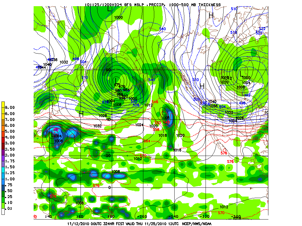
Wow! The models actually showed this 16 days ago. Not this exact scenario, but this idea. Pretty crazy. Then they shifted to highs in the 40s, believe it or not. There is not a lot of data over the arctic, so models commonly have problems with these situations. Given that it is a La Nina year, I expect that we will see more arctic outbreaks. This is definitely a good way to start. :).

To wrap it up - cold tomorrow and FRIGID Wednesday morning, before moderating while remaining mostly dry through Wednesday. A more active, typical storm track will return after a system affects us on Friday.

1 hour, 12 minutes (now I'm going to post how long I've worked on these. Hopefully someday I can count them all up. :)
Charlie

Monday, November 22, 2010

Yes, I failed!!!

Monday, November 22, 2010
6:22 P.M.

WOOHOO!!! I can't believe this is happening. Winter storm warning and 2 inches of snow and counting! The models predicted zip. Cliff Mass predicted zip. Scott Sistek predicted pretty much nil. I gave you a 5% chance of snow. The National Weather Service was just ignoring the models and going on their own judgment, which I thought was silly because one of the models was very very consistent (the GFS) in showing no precipitation whatsoever for us. Well, they were definitely wrong. And we have gotten very cold. I just got a report from Nicholas Efthimiadis of an air temperature of 23 degrees with three inches of snow. The extremely cold weather and extreme warm weather in Alaska due to a huge ridge over the central Pacific that is making all this possible in the first place has given us something I thought I would never see in my lifetime. Barrow, Alaska, the northernmost point in the U.S. and well within the arctic circle (they are seeing no daylight right now) is warmer than us. That is truly phenomenal. They are 25 right now. We had a high of 32, they had a high of 34. I don't know what else to say but that I'm completely blown away. I can't ever recall a time of that happening.

So what is happening tonight?
Right now we have periods of light snow that I expect will intensify in the next hour or so. Now, most weather guys would tell you that and just end it there. But I'm not content. This blog is about explaining WHY some things happen, so that you can leave each read with a better understanding of Pacific Northwest weather and have an appreciation for it.
 As you can see, there are some snow showers around the area. There is not much upper-level motion in the atmosphere right now - that is: the precipitation isn't really moving - but as you can see, there is a fairly wide swath of snow to our north, with some embedded heavier rates (like the yellows you see). Now, this isn't moving much, but it is moving to the south very very slowly. Snow has already increased around my area, however. There is a good chance that this feature could give us quite a bit of snow, especially it stalls over us and intensifies. By quite a bit of snow, I mean above 4 inches. That is a possibility, particularly if this feature has a convective element to it. A convective element is pretty much instability in the atmosphere.

Alright, so we got that out of the way. What will happen tonight?
The models have been pretty consistent with wind. I haven't seen the new GFS come out, so this is the model from this morning, but I suspect that the forecast will now be for even higher winds because the low that did come in was MUCH stronger than forecast. I'm sure you were able to figure that one out. this will create tighter pressure gradients. I would not, under any circumstances, be surprised to see a 80 mph gust up by Bellingham. Even Seattlites will encounter brisk windchills in the teens with gusts up to 40 miles per hour, or perhaps even 50 miles per hour in spots. I will look again at the new models when they come out tonight and update this forecast. But anyways, here's a graphic for 10 P.M. tonight, showing some rather high wind gusts from the northeast, especially by Bellingham. Windchills there will be below 0 in most spots. Cold temperatures combined with losing power present a danger, so if you know people who lose power or do lose power, do things to keep warm. Start a fire. Get a blanket. Use a generator if you have one, but do NOT under any circumstances put the generator in your house. This causes asphyxiation and you will die.
The San Juans in particular will get pounded. There may be some freezing spray, so it is a very bad idea to be out there. Storm force winds and frigid temperatures. Don't be out there tonight.


Photo disclaimer - I LOVE Andy Wappler. This is just a photo one of my friends made satirizing all weathermen who claim there will be snow, then students don't do their hw, and then they get bad grades. I do NOT think any weatherman is a douchebag. But if I had a final and I was lazy and the snow forecast didn't consolidate, I'd be kinda tempted to call the weatherman a douchebag. If I mess up and your grades are affected, there is an official 24 hour window from the beginning of the school day to the next where you may call me a "Douchebag."

Of course, the issue of people hating weathermen is going to come up, although I think it applies more for when snow IS forecasted and doesn't come true. It's easy to say "why didn't we think this" in retrospect, but the fact is, weather is a prediction. You never for sure know what is going to happen until it already is happening. So the best we can do from events like this is learn from them, and if we see a similar situation evolving in the models, take it with a grain of salt, because our models are not perfect. There lies the main difference in forecasting between the two powerhouses of Pacific Northwest weather prediction, the National Weather Service's chief forecaster Brad Coleman and UW's atmospheric sciences professor extraordinaire Cliff Mass. Cliff goes with the models more, while Brad has more human input. I'm generally with Cliff, although I do definitely take historical context, satellite, radar, and other stuff into context. He does too. Two years ago, the models were forecasting snow, but it was a really chancy situation and nobody believed it would happen. NWS said slushy accumulation of an inch possible. I said we could have 4 inches. We got 6. It's hard though, so cut us some slack.

The snow is increasing and will continue to increase. Tomorrow will be VERY cold. I need to eat dinner with my family, but I will look to make another update later tonight. Recap - up to 4 more inches of snow is expected tonight as this feature moves down from the north, keep an eye out for convection, and wear a coat. And PHOTOGRAPHERS!!! Take some shots tomorrow, it will likely be the clearest day of the entire year. Extremely low humidities, and the mountains will have snow. Parents are getting anxious. Ciao. :)
Your local weatherman,
Charlie Phillips

FOR THOSE INTERESTED IN POSTING SNOW TOTALS - Post them as a comment. Hardly anybody comments on my blog. I'd like to change that!!!

Sunday, November 21, 2010

Snow chances today and tomorrow

Sunday, November 21, 2010
12:28 P.M.

Hey guys. Some of you saw some snow flurries this morning. Some of you did not. It depends on where you live and your elevation. I say some flurries but no accumulation. It was pretty though.

Let's discuss snow probabilities. I read Cliff Mass' blog the other night and he said "forget about snow in Seattle, it's going to Oregon." He's probably right. The models which are usually more accurate (the Euro and GFS) have been showing this scenario, and they have been showing it consistently. The Canadian model has also been showing it as well. The latest 12z run of the UW 4 km GFS, our region's best model, shows absolutely no accumulating snow for Seattle (except traces).
Notice how there is a good amount of snow south of Olympia. But we don't get any.
However, the NAM model does paint a better picture for snow enthusiasts and school procrastinators around the region. It shows a bit of snow later today, maybe accumulating to an inch in spots, although most places will see no accumulation. The bigger story is the Puget Sound Convergence Zone that it is forecasting for Monday. The timing would be weird - it is forecast to occur during the morning of the school day. But it might deliver a few solid inches of snow to the area if it does verify. However, the NAM has not been consistent, and the GFS is the preferred model here. Sorry guys.
However, as you can see, through 4 P.M. Monday, it shows 1-3 inches of snow over Seattle. Your biggest tool here will be the radar. Keep your eyes peeled to the radar because we may not know what is actually going to happen until it actually is.

I need to do more hw, but I'll update this more if needed. However, that's most of it right there. Perhaps some snow, but not likely. Any snow we do have is likely to be focused on South Seattle with points north and south getting some as well.

However, the models aren't accounting for the large wave of hope providing HOPE on some of the clouds here as well as a possible arctic front of BELIEVE sweeping down from the north. Thanks will. :)

Have a nice day,
Charlie

UPDATE - 1:09 P.M. The National Weather Service now has a WINTER WEATHER ADVISORY for all of Western Washington. 1-3 inches expected Monday, according to them, and up to two inches in isolated spots tonight. I'm not sure if I believe it yet though...

Tuesday, November 16, 2010

The Truth About Snow

November 16, 2010
8:53 P.M.

Alright ladies and gents, it's time to tell you the TRUTH about snow in the upcoming days. There have been a lot of rumors flying around. I don't know if I've ever told you, but I hate rumors. But not weather rumors! Weather rumors create an exciting atmosphere (there's a knee-slapper right there). However, I don't want you guys to get your hopes up and then have a massive let down, because snow is a chance at best. However, I am becoming more optimistic about it after seeing the latest model runs.

Before, models were showing most of the cold air being shunted to our east, which is what usually happens. The location of the arctic high has to be just perfect to direct significant arctic outflow into our area. Why? Because we have not one, but two major mountain ranges ready to funnel air to our east. The air has to be just far west enough to avoid these mountain ranges, but if it is too far to the west, it will moderate over the ocean. It's one of those classic situations in which even small changes in the models could have huge changes in the forecasts.

Let's first discuss the most likely scenario, which, at this point, is a blend between the European (ECMWF - European Centre for Medium-Range Weather Forecasts, if you wanna impress your friends) and American models (mainly the GFS - Global Forcast System) as well as just common sense with what usually happens with predicted snow events (i.e. - one thing can completely screw it up). Most t.v. forecasting stations are predicting dry-ish conditions once the cold air sets in, which is correct, and they aren't going all-out on the intensity of the cold air, which is what I am also forecasting.

Let's break it down. Tomorrow, we will be wet and rainy. The mountains, however, will be very snowy. I have a feeling that the models are underdoing the precipitation for Snoqualmie Pass. They are calling for around 8 inches of snow there, but I'm expecting a foot. The orographics are very favorable for snow in the passes from the looks of it. The volcanoes will get pounded. Don't be surprised if Paradise and Mt. Baker pick up 2-3 feet of snow from this storm. The below model shows the thickness of the atmosphere near the surface to the 500 millibar level (level in the atmosphere where the air pressure is 500 mb) and is measured in decameters. Don't ask me why it is measured in decameters, it just is. But anyways, the brighter reds and yellows mean that the temperature in the atmosphere is higher because the number of decameters it takes to cross 500 mb in the atmosphere is greater, meaning the air is less dense (warm air is less dense than cold air). The blues, purple, and whites mean colder air. Once you get to around the 522 decameter level in our area, it's time to start thinking about snow.

This image shows the low off Vancouver Island, and you can tell there is a front over us because of the large change in thickness (a front divides different air masses). This forecast is for tomorrow Wednesday at 1 P.M. PST. Now, watch what happens.
The low has weakened and moved to the southeast, right off of our coast. This is a crucial detail in the forecast. Dropping this low southward now gives us winds from the northeast. And there is a lot of purple to our northeast.
I don't think that that low is going to be strong enough to pull in a whole bunch of arctic air. However, a reinforcing shot of arctic air might hit us early next week. The models are showing different things, but the GFS model (shown) has been consistent in showing this solution. Unfortunately, we also run out of moisture.

So the question remains: will we get snow?
There is a chance we might get a few isolated snow showers over the weekend, but I don't think they will be heavy and widespread enough to close school. However, if a convergence zone forms over Seattle at night and dumps a whole bunch of snow, we may have a shot at a day off. One of the models was showing highs in the low 20s for Seattle and snow totals of 8-18 inches for us. I doubt that is going to happen, I'm just using it to illustrate how tough of a forecast this is. I think our best shot at snow is either with an arctic front with the reinforcing shot of cold air (and then it would freeze on the roads as the arctic air sets in) or an overunning event with a system off the Pacific "overunning" the cold air, producing snow. That is a very real possibility. But so many things could change. A couple things are for certain - it will get colder - the mountains will see snow - and the days will keep getting shorter until the winter solstice.

I HIGHLY recommend friending Scott Sistek and Steve Pool on facebook. Type in "Scott Sistek weather" and "Steve Pool komotv" and they will come up. They provide discussions, but their walls are also discussion places for me and other weather nuts to discuss what we see in the models. It's a very fun place!

On the windstorm last night - it was very unique, I'll talk about it some other time.
Pray for snow please. :)
Charlie

Thursday, November 11, 2010

Charlie Phillips' LAWES (Likelihood of an Arctic Weather Episode with Snow) scale

November 11, 2010
9:09 P.M.

Making an acronym that sounds like an actual word (aka: not MOFACASOSWWWW - Major Outbreak of  Frigrid Air, Copious Amounts of Snow or Other Severe Winter Weather in Western Washington) actually took me a really long time. And I'm sorry I haven't been updating this, the weather has been boring and I've been absolutely swamped with schoolwork. However, there could be some interesting weather on the horizon and the quarter just ended, meaning that although I still have a ton of college apps to do my schedule has lightened up slightly.

So, lets go through this scale.
LAWES level 0: You are on a planet that has the ingredients necessary for snow
LAWES level 1: Models are showing a chance of snow beyond a week out, 0-20% chance of snow
LAWES level 2: Models are showing a chance of snow within a week, 20-40% chance of snow
LAWES level 3: Models are all showing a scenario that would easily produce snow within a couple days, 40-60% chance of snow
LAWES level 4: Places around the area are already getting snow AND snow is forecasted for Seattle, 60-99 % chance of snow
LAWES level 5: Snow is occurring, 100% chance of snow (derp)


Now, notice how there are no measurements for how strong a Seattle snowstorm could be. But have no fear! That's what suffixes are for.
Ending in:
.1 - 0-2 inches of snow
.2 - 2-4 inches of snow
.3 - 4-6 inches of snow
.4 - 6-8 inches of snow
.5 - over 8 inches of snow
.6 - board the next plane to Panama

So a level 5.6 (below) would mean that snow is occuring and that you should leave the country if possible. Photo props to Alex Jonlin. That storm brought 21.5 inches of snow to Seattle in 24 hours.


Now that that is out of the way, let's discuss the weather forecast. This week is boring. If you want to know about this week, go to a different blog. However, things get rather (pause) "interesting" (sly smile and rubs his hands together) next week. The atmosphere will shift into a classic La Nina pattern, with a HUGE ridge over the eastern Pacific and then a trough on the eastern coast of it (us), directing arctic air down from Canada into the western U.S. Now, there are a lot of questions remaining about this scenario - how cold will the air mass be? How far west will it go? Will it be deep enough to cross the mountains into Western Washington? Seeing as the models have been inconsistent, I am giving this a LAWES advisory level 1 (no specific sublevel), which means there is a 0-20 percent chance of snow occuring in the lowlands. I will keep you posted on if things change. One thing is for certain though. The rest of the country will get extremely cold. We just don't know if the arctic high will go west enough for us to get some of the cold air.


This model shows the weather forecast for a whopping 2 weeks out. That is way too far out to look at individual storms. However, you can look at trends. Here, the models show an arctic high diving into Western Washington and giving us cold air. That's what all this fuss about snow is. We will see if it comes true!
Have a nice night!
Charlie

P.S. The Garfield News Network needs another weatherman! If you are interested in the position, let me know, and we will see if you can get the spot!