Tuesday, April 30, 2013

Never Too Late To Snow

Monday, April 29, 2013
10:52 P.M.


First off, let my apologize for my lack of punctuality when it comes to posting these blogs as of late. I've been very busy recording an album for a funk band I am in, and I have had a string of seizures to boot. Thankfully, the album is almost done, and I'll be going into the Swedish Neuroscience Institute on Thursday to get some brain tests done and see if we can get the seizures under control. If anybody knows how to fix the human body, it's those Swedes. I've also been in the process of writing a more in-depth post about a climate talk I went to, but when the Snoqualmie Pass WSDOT cams took my breath away today, I knew that the Weather Gods were calling upon me to write a quick blog in the immediate future.

In any event, I hadn't been following the weather closely, so I was extremely surprised when I saw a layer of white covering I-90 from Denny Creek to Easton. I've seen Snoqualmie Pass covered in snow in mid-June, so it wasn't the time of year that had me trippin'. What really struck me was that most regions in the sound reached the mid-to-upper 50s today, which meant that for there to be sticking snow at Denny Creek (I think Denny Creek is at approximately 2,000 feet), there must have been an incredibly steep environmental lapse rate (decrease in temperature with height). This would imply that the atmosphere was very unstable, but I don't recall seeing any massive cumulonimbus popping up over the area this afternoon. 

I tried to get the Sand Point profiling data which would give me an estimation of how the temperature varied with height, but I was having problems opening the .gif files from the profiler. Instead, I decided to look at the radiosonde soundings from the 00z Quillayute weather balloon launch. The plot below shows the temperature and winds as a function of increasing elevation (and hence decreasing pressure), and it also gives the statistics for things like CAPE (Convective Available Potential Energy) and other acronyms that are Greek to me.


This plot is called a "Skew-T" plot because the axes for temperature are angled and have a positive slope instead of simply being vertically oriented parallel to the y-axis. At first glance, it would look like the temperature more or less remains the same before increasing in the upper levels up the atmosphere, but once you know that this t-plot is skewed, you know that the temperature decreases until it more-or-less flattens out above 200mb. We are concerned with the air near the surface, and you can see that there is an extremely rapid decline in temperature with height between the 1000-900mb levels.


Here are the current conditions along I-90. Seattle has cooled down to 46 degrees, but it is still snowing well below the pass. This snow will continue throughout the night before dying down tomorrow morning.

The Summit at Snoqualmie is technically still open for the season, and they claim that the last day they will be open is May 5th for Cinco de Mayo. I hope to be up there listening to Jimmy Buffett with the best of 'em, but even if that doesn't end up happening, I would not be surprised in the least if they extended the season for another week. This is what happened during the massive snow year of 2007-2008, and I skied the Alpental Backcountry on Memorial Day of that year, which was officially the last day any part of the Summit was open. Don't count on them keeping it open much longer though... even if there is enough snow, they still gotta find a way to make a profit. And if only season's pass holders are coming up to the slopes, Boyne is losing money.

Thanks for reading! My brain is still a little scrambled for a seizure I had Sunday night, so if you come across any awkward phrasing, cut me a little slack. I'll get my other post-in-progress up soon.

Charlie

Saturday, April 20, 2013

A Taste of Summer

Saturday, April 20, 2013
12:28 A.M.

Long Beach, California - Taken April 3, 2013 using a Nikon D3000. Photo credit: Michael Trofimov.
Hey everybody. Sorry for leaving you guys hanging for a couple days, midterms called. I think I had a false sense of this quarter being easy just because I have relatively more time compared to last quarter. Well, it turns out I still have a lot of work to do, more than I anticipated.

On another note, the above picture was taken by Michael Trofimov, a fellow weather buddy who is four years my junior and therefore still in high school. He's an extremely bright kid and takes some great pictures, and he's given me permission to use them on this blog. His Flickr Photostream is here, and I'll also post his site under the "My Favorite Weather Links" list on the left side of this blog. Thank you Michael!

This last week has been pretty darn wet. So wet, in fact, that it has pushed our April rainfall total to the second-highest total on record at Sea-Tac. The record for April precipitation is 6.53 inches, and this was set way back in 1991. As of 6 PM Friday, we've received 5.49 inches, which is 3.63 inches above our average value to date: 1.69 inches.

January had 4.16 inches of rain, February had a measly 1.58 inches, and March had 2.74 inches. These values were all below average, with those months averaging 5.57, 3.50, and 3.72 (yes, March is rainier on average than February!) inches respectively. Thus, our average value through these three months is 12.79 inches, and we received 8.48 inches, leaving us 4.31 inches below normal. As of 6 PM Friday, we have received 13.97 inches since January 1 (and probably over 14 inches by the time I will be finished writing this blog), which is only 0.68 inches below our average yearly-to-date value of 14.65 inches. Well done, April.

By the way, I got all these climate statistics from "Climate Data" under "Data and Forecasts" from the University of Washington atmospheric sciences department page. Here's the link: http://www.atmos.washington.edu/data/data.php?loc=climatological.

I wish we could use the next eleven days of the month to smash the rainfall record, but that won't happen. We look to be entering an extended period of abnormally warm and dry weather. Here are the predicted 6-10 day temperature and precipitation anomalies over our area from the Climate Prediction Center. Take a look for yourself, we will be warm and dry.


Here's a look at the 500 millibar chart for Monday over the Eastern Pacific. The semi-permanent Eastern Pacific High is creeping northward, a sign that summer isn't too far away.

Valid 08:00 pm PDT Mon, 22 Apr 2013 - 75hr Fcst: UW 00z WRF-GFS: 36km 500mb absolute vorticity, heights
This trend looks to continue for the foreseeable future. Brace yourselves, we are in for a boring ride.

Charlie

Monday, April 15, 2013

How to: Take a Shower

Monday, April 15, 2013
4:34 P.M.


Last night, I had a spiritual revelation of sorts. I had just finished shaving (my face) and was getting ready to hop in the shower. I eagerly turned on the water, but after about five seconds or so, I estimated that the temperature had only risen from ~50 degrees at the start to ~70 degrees, and it plateaued there. I was extremely discouraged that all the work I had put into successfully taking a shower had gone to waste, so I trekked 20 feet back to my dorm room to try and kill time for 20 minutes while waiting for the water to heat up.

Twenty minutes later, I marched straight into the bathroom and authoritatively turned on the showerhead. Much to my dismay, the water temperature was still a bone chilling 70 degrees. This time, though, I wasn't just gonna let this water be the boss of me. I was going to own the shower and nothing was going to stop me from scrub-a-dub-dubbing.

As I attempted to boldly glee as the frigid water trickled down my back, I came to an amazing realization. I realized that if I wanted to keep warm, I should use the absolute least amount of water possible. So, after dousing myself for a good 60 seconds, I turned the shower completely off and proceeded to wash my head, shoulders, knees and toes. I was able to get them pretty clean... I feel like the increased friction due to the relative lack of water made for a more effective cleansing method, as I had the ability to apply more force towards unearthing the unwanted grime that covered my body due to the higher friction coefficient k of slightly moist skin as opposed to wet skin.


After I was done evacuating the unwanted contaminants nested upon my epidermis, I proceeded to turn the water back on and wash everything off. The whole washing off process probably took around 90 seconds, as I needed to get the shampoo off my hair and get the soap off everywhere else. The soap was deeply nested in my skin and didn't just slide off by itself... further evidence that when it comes to scrubbing, a little lubrication goes a long way.

Soon, I was fresher than Bel-Air, and I only had the water on for around 2-3 minutes.

People always say that the trick to reducing water usage is to take short showers with low-flow showerheads. While there is definitely truth to this statement, the shower is more than just a cleaning cubicle. Some of life's greatest awakenings occur in this sacred place. With my newly embraced shower-taking method, I can use minimal water in a slippery, soapy silence, and shine brighter than the sun with the knowledge that somewhere, some salmon is smiling.

Charlie

Saturday, April 13, 2013

Die Another Day

Saturday, April 13, 2013
5:04 P.M.

From Wednesday, April 10, 2013:

"We'll have some rain coming in Friday afternoon, but I'll bet my life on having a strong convergence zone somewhere in the area Saturday afternoon due to a cool, moist, onshore flow splitting around the Olympics and converging somewhere along Puget Sound. If I'm still alive on Sunday, you'll know I was right."

Well, it looks like I will be alive on Sunday, and more alive than I've ever been.

Alright, well know that ya'll know I'm like... the best forecaster ever... let's actually talk about what is happening outside right now.

Camano Island Radar: 04:58 pm PDT Sat 13 Apr 2013
This is the radar picture taken from the Camano Island radar at 4:58 pm today, and you can see that there are a lot of showers around Puget Sound. Interestingly enough, there actually look to be two convergence zones, one over the San Juans and another, stronger one directly over the Seattle area. Because there are so many other showers in the area, it is a little tough to make out zone over Seattle, but as evidenced by the band of precipitation and the extremely heavy showers embedded within this band, it is there.

The scale on the right uses different colors to denote different rainfall rates. More specifically, it measures dBZ (decibels relative to Z), and is the meteorological measure of Z (reflectivity) of a radar signal reflected off an object. This is a logarithmic scale, so small increases in the scale represent much larger increases in reflectivity (and therefore precipitation in most cases). Whenever you see reds on this radar, you can be assured that there is heavy rain or hail in the area, and if you look closely at this picture, you can see that the reds are centered right over Seattle.

UW Campus looking out over Red Square: ~ 5 pm
I've counted about 4-5 lightning strikes at the UW in the last 15-20 minutes or so, which is quite a few for a springtime northwest thunderstorm. There was some hail mixed in with the rain at one point, which indicates strong updrafts and instability within the shower, as hailstones cannot form without updrafts suspending them to a point where they can accumulate ice before they finally become too heavy and fall to the ground. Right now (5:23), the rain has almost completely stopped, so let's take another look at the radar.

Camano Island Radar: 05:18 pm PDT Sat 13 Apr 2013
As you can see, the rain has moved south of the UW area and is now directly over downtown Seattle. The actual shape of the convergence zone is better defined in this picture.

1km resolution GOES-West: Pacific Northwest Visible Satellite 05:00 pm PDT Sat 13 Apr 2013
You can even see the convergence zone over Seattle on the satellite. See that little finger extending westward from the Central Cascades over to Hood Canal? That's the convergence zone. Another thing to note is the incredible rain shadow over Eastern Washington. Look at how the clouds just completely die out once you move to the east of the Cascade crest and there is downslope flow. Simply beautiful stuff.
With the cold air aloft, there are very low snow levels. The passes are getting hammered, and I even heard of a few snowflakes flying by Western Washington University this morning.

The convergence zone should gradually dampen as we head towards midnight, but I'd still be on the lookout for a couple more strikes here and there. Springtime Pacific Northwest weather... it can be exciting!

Stay safe.
Charlie

Friday, April 12, 2013

Working Together to Forecast Weather Better

Friday, April 12, 2013
2:57 PM

If any of you ever watched a certain t.v. show that's about more than just card games, you are familiar with the picture above.
We need to work together more as a society in general. I mean, look at Congress. The rifts between the Democratic and Republican Parties are huge, and progress is being stifled by people who are unwilling to make compromises. I disagree strongly with a lot of the actions that are being perpetrated both domestically and abroad by our government, and I know that a lot of my priorities don't match up with those being debated in our nation's capital. However, even if I disagree, it is still better to try and work out a solution that works for the majority of people rather than just debate, pass, filibuster, veto, etc. One of the sectors that is in the most dire need of cooperation, though, is the meteorological sector.

There is plenty of international cooperation when it comes to climate change. There is a conference called the IPCC (International Panel on Climate Change) that has produced four major scientific reports drawing upon scientists all over the world with the first one occurring in 1990 and the last one occurring in 2007, with the next one expected to be completed in 2014. The Kyoto Protocol (1997) to the United Nations Framework Convention on Climate Change (UNFCCC) is an international treaty that restricts the amount of greenhouse gases that an industrialized country can release. Greenpeace, a non-governmental environmental organization that has offices in over 40 countries, focuses on essentially everything necessary to keeping our earth green and peaceful, and climate change is one of their chief priorities. There are countless other organizations that work together to research paleoclimate, assess our current climate and GHG emissions, and predict future scenarios based on the magnitude of GHGs emitted into the atmosphere, with particular emphasis on predicting both the direct warming from the greenhouse effect due to these gasses and the additional warming that will be experienced due to positive feedbacks, as there are far more positive feedbacks than negative feedbacks at this time. One of the strongest positive feedbacks right now is the relationship between declining sea ice in the arctic and an increased absorption of solar insolation due to the much lower albedo of water. Just to clarify, albedo represents the amount of solar radiation radiated back into space. Snow has a high albedo, so it reflects a bunch of solar radiation to space. Water has a low albedo and absorbs most of this radiation, thus warming the planet at a higher rate.

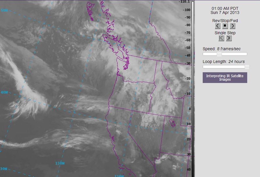
Unfortunately, the meteorological sector of atmospheric sciences is dominated the competition and not cooperation. While some competition is good (basketball games would be really boring if the teams both tried to help each other win), competition results in inconsistencies in data collection and forecasting. This was brought into the forefront of American media when Superstorm Sandy hit the United States, as the European model consistently forecast a U.S. landfall while the American model took the storm harmlessly out to sea. Around a month ago, the two main American models, the NAM and the GFS, predicted a monster snowstorm to hit D.C.. The storm never came. To be fair, this was an extremely difficult forecast and made forecasting Sandy look like a piece of cake, and even the European model wasn't perfect. However, it produced far less of a snowstorm than the American models. The bottom line is that there are countless examples of the European model clearly outperforming the U.S. models, and there are very few examples of the U.S. models triumphing over the European model.

Now, at first glance, it may seem like I'm trying to advocate for the U.S. to simply try to hitch a ride with the European model to improve their weather forecasting. Well, it'd be nice if we could run UW's super high resolution mm5/WRF models using output from the European model, but I believe we could even improve upon the European model if we lumped our resources together. The European model has ten times the computing power of the GFS, yet we have some extremely powerful computers that we would be using that are currently being used for other services, particularly climate prediction. If we could work together with the Europeans to "spread the responsibilities" of meteorological and climatological prediction, we would certainly end up with better forecasts for the short term. Much of climate research is applicable worldwide (after all, when was the last time there was an international conference on Puget Sound Convergence Zones?), but meteorological research pertains to certain areas. We share our expertise on climate with the world, but we have limited access to the extensive numerical prediction programs that are occurring in Europe. If we could further propagate our research throughout the world and create agencies that work across countries (ex: not NOAA or NASA but something that all countries are involved in), I feel like we would have better success. I'm sure there are some agencies like this, but I cannot name any off the top of my head. Regardless, I still think they are a good idea.

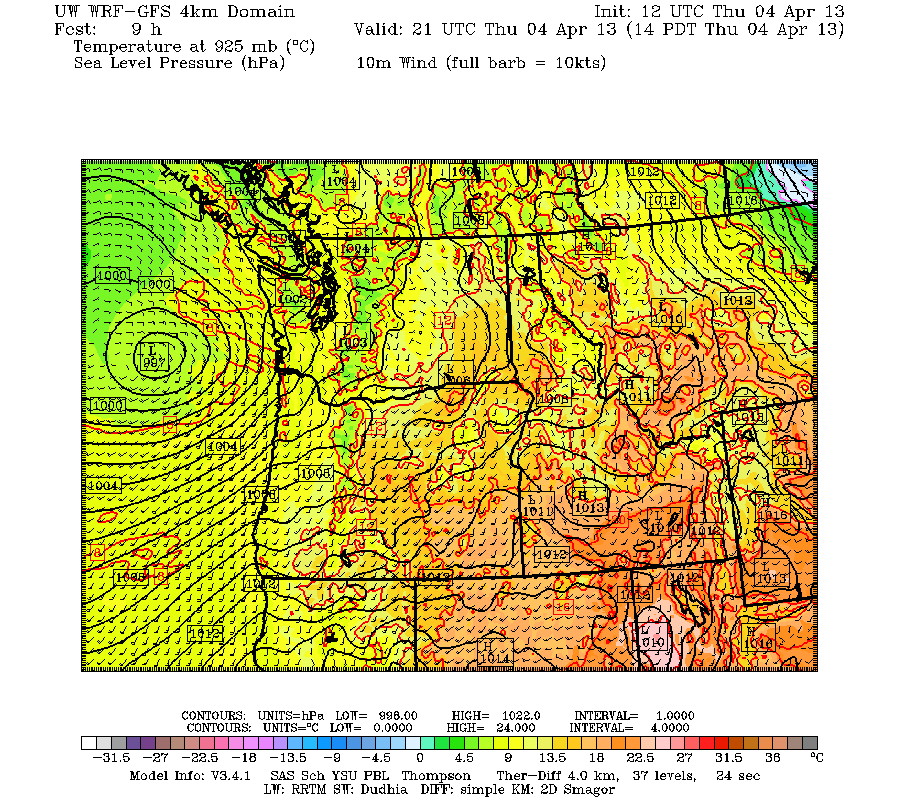
Additionally, there is research that has been done by the U.S., particularly for mesoscale modeling, that has not been done on the same scale in Europe. A prime example is our high-resolution models that have a resolution of 4/3 km. This is extremely useful in predicting certain types of weather in certain regions, but it is useless if the models they are initialized off of (like the GFS and NAM) are poor forecasters in the first place. If we could share our knowledge, research, and resources dedicated to mesoscale meteorology with the European's clear advantage in synoptic scale meteorology, amazing things could be accomplished.

But wait, there's more! In the U.S., we have a very cool program associated with the National Weather Service (NWS) called "CoCoRaHS" (Community Collaborate Rain, Hail, & Snow Network) where volunteers send in daily precipitation reports. On average, 18,000 - 20,000 precipitation reports from average citizens all across the U.S. and Manitoba are reported each day. That's a lot of precipitation reports. Because of the higher computer power that the European model has, they can take in more data and therefore obtain better forecasts by being more specific with their numerical inputs and avoiding the need to "approximate" what the weather would be in certain locations between the data points. I do not know if the ECMWF (European Center for Medium-Range Weather Forecasts) has a system like this, and I also do not know if any of the models use any of this data. Still, it just goes to show that there is plenty of data available, and by combining resources with those Europeans, we could achieve even better weather forecasting.

I am technically a CoCoRaHS member but I have had problems with my weather station and haven't sent in reports. It's something I definitely want to do in the future; it's a great way to help education and research applications. You definitely learn a lot about simple ways to accurately measure precipitation and report it to the NWS. Anybody can become a CoCoRaHS member, but you are required to attend a training session (either in-person or online) to be certified and have your reports actually be recognized by the NWS. It's something I'd highly recommend; you can apply here.

I should point out that I believe it is important to have different weather models, however, as the equations that each weather model uses to create forecasts from numerical data are slightly different. Often, the weather that ends up occurring is a "blend" of what was forecast by individual models, so it is definitely important to have different models. Another thing that is becoming more and more common in weather forecasting is the use of "ensembles" of output from models, with each ensemble using a slightly different set of initial conditions. This statistical and probabilistic approach to weather forecasting has been proven to have greater accuracy than the "operational" approach, which just uses all the data from one set of initial conditions (at least to my knowledge, somebody please correct me if I'm wrong). The UW runs their own probability forecasting tool for the Pacific Northwest, and the few times I have used it, it has done an exceptional job, particularly with short-range temperature forecasts. You can learn more about it here.

I know I've written a lot... I'm not the best writer by any means and I'm definitely not as knowledgeable about this subject as I would like to be, but to sum things up, the Americans and Europeans could share the resources they have between them and obtain better forecasts as a result. And as we saw with Hurricane Sandy, the benefits of doing so would be crucial to the health of our economy and the safety of individuals.

On another note, the competition between private sectors can also have negative consequences for the accuracy of forecasts. Most people do not get their weather information from the NWS; they get it from guys like Al Roker, Steve Pool, Jim Cantore, and large commercial organizations like The Weather Channel or Accuweather. Now, my understanding of the economy is extremely poor, as evidenced by this meme I just made.


However, I do know that some weather sites have resources that others do not, and that weather forecasts would be better communicated to the public if these private companies helped each other out and built upon the resources that each of them have.

Perhaps somebody could take these ideas that I have laid forth on this blog and think of some way to practically apply them. But the benefits of increasing weather forecasting accuracy would be huge, and I believe that international, domestic, and commercial cooperation is a very efficient way to do this.

Charlie

Thursday, April 11, 2013

Small Zone, Intense Convergence

Wednesday, April 10, 2013
10:30 P.M.

I don't own an umbrella. I don't own rain boots.The only thing that I need to protect me from the elements is my skin. It's worked out pretty well so far.

But today, when I walked out of a physics lab, I saw looked out the window and saw a torrential rain shower that ranks up with the heaviest I've ever seen in Seattle. I wanted to head over to a different physics building that was a measly 50 feet away, but I had to sprint across the pavement to keep from getting absolutely drenched in water. I suddenly wished I was enclosed in some sort of waterproof force-field, like the ones Violet made from The Incredibles.

Source: DisneyScreenCaps
However, the rain was still nowhere near as heavy as the rain I witnessed at my house between 4 and 5 P.M. on December 14, 2006, which was the day of the Hanukkah Eve Storm. I don't think I've dedicated a specific blog to urban flooding, but I will do so in the future. Kate Fleming, an award-winning audio book producer and narrator who lived in Madison Valley, died when she drowned in her basement due to rising floodwaters from the downpour, and a more effective water drainage system was built soon afterward to prevent a tragedy like this from ever happening again. Below is a Youtube video of that storm... I will never, ever forget the roar of the rain outside my house. Rest in peace.


Whereas the 2006 Seattle flooding event was associated with the most damaging windstorm to hit the Seattle area since 1962, this brief downpour was associated with a weather phenomenon Seattle natives should be quite familiar with - the Puget Sound Convergence Zone.

Retrieved from Colorado State University's Virtual Institute for Satellite Integration Training (VISIT) "Meteorological Interpretation Blog"
The idea behind the convergence zone is pretty simple... winds coming off the ocean (typically from the northwest in the wake of a cold front) are directed to the north and south of the Olympics through the Strait of Juan de Fuca and the Chehalis Gap, respectively. These air masses curve into the Western Washington lowlands, converge, and cause clouds and precipitation. The result is a band of precipitation that generally stretches across the lowlands into the mountains and is located around the King/Snohomish county line. However, I have seen convergence zones form in Skagit and Pierce counties as well.

Let's take a look at a radar image that shows the convergence zone we saw this afternoon.


This is a pretty typical convergence zone for the area. It is roughly perpendicular to Puget Sound and extends into the Cascades. It is a little further south than normal and doesn't extend as far westward as some other convergence zones I've seen, but it's still a pretty good example nonetheless. If you take a look really closely, you can see a tiny but intense shower embedded within the convergence zone over the UW campus. Meanwhile, places a mile to the north or south were completely dry. The Pacific Northwest may not get big supercell thunderstorms or hurricanes, but we do have some local weather features that keep things interesting around here, and the convergence zone is one of those.

If I had to estimate, I'd say rainfall rates were around or slightly over an inch per hour for the 10-second duration it took me to run from one building to another. I checked the UW atmospheric sciences building rooftop data and it said that there were 0.05 inches of rain from 2-3 PM and 0.07 inches from 3-4 PM. This just goes to show that when it comes to heavy rain, I was in the wrong place at the wrong time. Had I waited a couple more minutes to flee from one building to another, I wouldn't have to wait an hour for my sweatshirt to completely dry. Yes, the rain was really that heavy. If you want a fantastic explanation of what a convergence zone is, check out Scott Sistek's page on it here.

We'll have some rain coming in Friday afternoon, but I'll bet my life on having a strong convergence zone somewhere in the area Saturday afternoon due to a cool, moist, onshore flow splitting around the Olympics and converging somewhere along Puget Sound. If I'm still alive on Sunday, you'll know I was right. :)

Charlie

Monday, April 8, 2013

Rainfall Totals From the Last Few Storms

Monday, April 8, 2013
1:02 P.M.

Photo credit: Wikimedia user "Rosendahl"
April is known for "showers and sunbreaks," which might as well become a trademarked phrase around here since it is probably the most commonly mentioned phrase in Seattle, meteorological or otherwise. Imagine how rich the original creator of that phrase would be if news stations and the National Weather Service had to buy rights to use it. That'd be an easy way to make a living.

This past weekend, though, we saw more showers than sunbreaks. In fact, we saw half an inch of rain on Saturday and an incredible, record-setting 1.54 inches of rain on Sunday. Scott Sistek of KOMO News (hands down the best station for weather news in Washington... nobody else even comes close) found that the 2.04 inches of rain that Sea-Tac saw this weekend made it the wettest April weekend since record-keeping began in 1948. Sunday was the fourth-wettest day ever in the month of April at Sea-Tac, and we absolutely demolished the previous record of 0.63 inches in 1984.

As of midnight Sunday, Sea-Tac has received 3.10 inches of rain for the month of April, which is over four times the normal amount by this date (0.74 inches) and slightly higher than the average total for the entire month of April, which is 2.71 inches. I have to give Scott Sistek and the KOMO weather page credit for these statistics... they are in the public domain, but the folks at KOMO sure saved me a lot of time searching for statistics. Scott's article can be found here, on his "Partly to Mostly Bloggin'" blog, which is only bested by my blog in terms of quality of information, writing skill, and overall content. Just kidding, his blog makes mine look like it should be drawn in crayon.

The artist was 1 year 10 months when this was drawn. Soft crayon on paper. Uploaded by parent. Photo credit:Wikimedia User "Monika Wirthgen/Menschliches"
The University of Washington is one of the premier schools in the galaxy for studying meteorology, and they've developed a nifty little tool called "Seattle RainWatch" with the Seattle Public Utilities. Here are some 72-hour rainfall totals over the area as estimated by the Camano Island WSR-88D radar.

72-hour precip from 11:56 PM 4/4/13 to 11:56 PM 4/7/13

Remember, this precipitation map is the precipitation as measured by the radar. The radar beam increases with height as it radiates outward from the Camano Island radar, so those places to the far south and west likely got more precipitation than the radar is showing. Also, you can clearly see the blocking effect that the Olympics and Cascades have on the beam in the above photo. In any event, there are extremely heavy 3-day precipitation totals over the region for April... it looks like some mountainous regions got over six inches during this span.

Here's another RainWatch graphic that is zoomed in on the Seattle area.

72-hour precip from 11:56 PM 4/4/13 to 11:56 PM 4/7/13

This graphic really shows how the precipitation was not evenly spread over the Puget Sound lowlands, especially the Seattle area. These look like slight over-estimates to me... I checked the UW rooftop data from the atmospheric sciences building and they only officially received ~2 inches for the period. Still, it gives a good general idea of the relative amounts of precipitation that fell over the area. It's interesting to note how much of Mercer Island and SODO was relatively drier than places north and south.

Will the wet weather end? No. I do not see any storms like the one we saw this past weekend on the horizon, but we do look to settle into a cool, unsettled pattern with showers, sunbreaks, and relatively low snow levels for this time of year, easily below pass level. It should be a great time to get some late-season turns in. I personally recommend the Alpental backcountry. Wait, nevermind, I don't want anybody messing up the perfect powder for me.

On another note, this is the time of year when we really start to see severe weather pop up in the nation's heartland. Joey Sipos snapped the below picture yesterday on his storm-chasing adventure in the middle of Kansas. Makes our storms look pretty pathetic.


Enjoy this period of extended chilliness while you can, because it ain't gonna be around forever.

Have a good one!
Charlie

Sunday, April 7, 2013

Sunday Surprise!

Sunday, April 7, 2013
1:03 P.M.

01:24 am PDT Sun 07 Apr 2013 - Langley Hill Radar

Last night, a surprisingly powerful storm rolled through the area. It's a shame that the brunt of it came while most people were sleeping, as I'm always down to watch a good storm, but I can get a glimpse of what it may have been like by looking at past radar and satellite images. And let me tell you, the storm that rolled through looked pretty legit.

If you take a look at the radar above, you can actually see the general form of the low pressure system. You can see the heavy rain ahead of the system, but the really amazing part is that little rain-free area off the coast. That area indicates the exact center of the low. Low pressure systems rotate counter-clockwise around their center in the northern hemisphere, and that little "hook" to the west of the rain-free area represents the front out ahead of the storm wrapping around to the west of the storm due to the counter-clockwise rotation of the low. This feature is known as the "bent-back occlusion," or, as Cliff Mass likes to call it, the "poisonous tail" of the low. In this system, the area of heavy rain centered over the Langley Hill radar looks to be much more poisonous, but in other systems, the bent-back occlusion is generally the area where the strongest winds are found. In the Hanukah Eve storm of 2006, many locations in Western Washington received their highest gusts a little after 1 A.M., right as the bent-back occlusion was coming through.

Here's a water vapor image of a strong bent-back occlusion back from February 4, 2006 just to give you an idea of what these features look like. The occlusion is to the west of the dry slot off the Washington coast.


Although a small bent-back occlusion is visible on the radar, it wasn't picked up very well on the satellite. Take a look at the infrared satellite picture I posted below, and try to find the occlusion.


If you look really closely, you can see the curl of the cold front extending upwards through the Willamette Valley before it turns into an occlusion and bends back down to the south off the Washington Coast. I put a satellite loop below. Try to see if you can find the time where the low undergoes cyclogenesis and develops the occlusion.


If you can, you are well on your way to becoming a meteorological genius. If you can't, just keep practicing.

 The models had hinted at a storm like this, but the details were tremendously muddy. I decided to take a look at the forecast discussion from the Portland NWS office Friday night, and here's what they had to say.


  MODELS ARE HAVING TREMENDOUS DIFFICULTY IN HANDLING THE NEXT SYSTEM 
  FOR SATURDAY NIGHT. GIVEN THE UNCERTAINTY WILL ISSUE A LOW-END WATCH FOR THE OREGON 
  COAST WITH THE AFTERNOON PACKAGE AND INCLUDE POSSIBLE GUSTS TO 60 MPH 
  ACROSS THE MORE EXPOSED COASTAL SITES.


The gusts ended up being higher than forecast, and the Willamette Valley, which was just expected to be breezy, was issued a wind advisory last night in accordance with the rapidly developing low. Off the Oregon Coast, Cape Foulweather had sustained winds to 46 mph with a gust to 75, the Yaquina Bay Bridge (near Newport, OR) had sustained winds of 50 with a max gust of 60, Timberline had a gust of 89, and even Portland had a gust to 44. Pretty impressive stuff. If you look at Saturday night's model run, you can see the tight, tight, tight gradient across the Willamette Valley.

Valid 05:00 am PDT Sun, 07 Apr 2013 - 12hr Fcst: UW 00z WRF-GFS: 12km 10-meter wind speed, sea-level-pressure

If you got the Tuco reference, you are well on your way to becoming a methamphetamine drug lord. If you didn't, just keep practicing.

This storm is in some ways reminiscent of the February 7, 2002 "South Valley Surprise," which you can read more about here. This is Wolf Read's "The Storm King" website, which is a great resource for learning about Pacific Northwest windstorms and reading about past events. The South Valley Surprise was a storm that hit south-central Oregon with essentially no warning and was much more severe than this one.

It also reminds me of the big snowstorm we saw in January of 2012 where a low was forecast to move to our south, leaving us snowless, but ended up coming further north, bringing Seattle a good six inches of snow and burying places like Centralia in 1-2 feet of the white stuff. Needless to say, I got this forecast right on the button... check out the "Models Pessimistic, Charlie Optimistic" blog under recent posts. Even in high school, I was the best forecaster in Washington for snow events. Don't believe me? Ask anybody at Garfield about that snowstorm with the huge bolt of lightning. They'll vouch for me.

Charlie

Saturday, April 6, 2013

Climategate

Saturday, April 6, 2013
1:16 A.M.


I've only recently heard of the "Climategate" scandal. Whenever I'd be looking at an online news article that had something about global warming and allowed people to comment on it, a surprisingly large amount of people would bring up the word "Climategate." Usually, they would juxtapose the mentioning of Climategate with some bold, unfounded statement such as "Global warming is a hoax." I wondered if this scandal would provide enough evidence to show that climate scientists were truly conspiring amongst themselves to try to convince the public that climate change was occurring when it was not. Being an innocent, naive college kid, I always believe that our government is wonderful and never lies to the public. As history has shown, this is not often the case.

I found a hard time believing Climategate because I thought it was simply impossible for all (or at least the vast majority) of incredibly smart climate researchers to participate in such a conspiracy. I also had my doubts that the Earth wasn't clearly warming. I wore sweats throughout elementary and middle school, and although I upped my style to shorts/jeans/khakis, the spinning image of me in sweats was implanted in many of my fellow high school students that I knew in middle school. As such, I was voted "most likely to wear sweats" in the Garfield High School yearbook. This winter, I've only worn shorts. If that's not incontrovertible evidence for global warming, I don't know what is.

The Climategate scandal began in November of 2009 when a server at the Climatic Research Unit (CRU) at the University of East Anglia was hacked externally. This hacker then copied thousands of emails and computer files and sent them to a variety of locations on the Internet. These emails eventually fell into the hands of climate change skeptics/deniers and became a popular subject for these people to blog about. In response to the content the emails, these people asserted that climate scientists manipulated data and attempted to suppress critics of climate change. These accusations of scientific conspiracy were rejected by the CRU, with the CRU claiming that the emails were taken out of context.

On December 7, 2009, there was an international climate change conference in Copenhagen geared towards solutions to mitigating climate change. Conveniently enough, these emails had reached the mainstream media at this time. In response to news of the conspiracy, The American Meteorological Society, the American Association for the Advancement of Science, and the Union of Concerned Scientists (UCS)  all stated their support for the scientific consensus on climate change.

The emails were reviewed by eight committees and were found to have no evidence of any fraudulent activity. Climate change skeptics, however, looked at certain emails (which were filtered by the hacker) and sought to provide evidence to the public of climate scientists saying things that contradicted with their opinions as made public or admitting that global warming was indeed a big fat conspiracy. These skeptics focused on a couple specific quotes that would seem to provide evidence of a conspiracy; one phrase that was used in particularly was "the fact is that we can't account for the lack of warming at the moment and it is a travesty that we can't." This sentence was taken out of context, as it was part of a discussion on monitoring energy flows involved in short-term climate variability. Regardless, skeptics jumped on these phrases and disseminated the idea of a massive conspiracy to the public.

The responses to these inquiries varied sharply along political lines. Many Republicans (most notably Wisconsin Representative Jim Sensenbrenner) argued that these emails provided clear evidence of data manipulation and suppression by scientists in order for them to achieve their own ideological and economic goals. Many democrats and scientists affiliated with the Obama administration agreed with the results of the inquiries and held that these emails were completely taken out of context and didn't do anything to undermine the "very strong scientific consensus" that the Earth is warming due to the anthropogenic emissions of greenhouse gases.

Climate skeptics suddenly became climate celebrities due to Climategate. There are always people who think some governmental conspiracy is going on, but these emails were taken as a golden ticket for skeptics to prove to the public that global warming was a big fat hoax. These accusations by skeptics were shot down by Nature, The Telegraph, FactCheck, the Associated Press, the New York Times, and a bunch of other high profile magazines, newspapers, and disseminators of scientific and political information to the public. Regardless, the rumors of wrongdoing were so widespread by this point that climate scientists received numerous email threats - in some cases, death threats - in the wake of the hacking.


These hackings did nothing to undermine the scientific consensus on climate change, but they did undermine the public opinion. One of my favorite quotes applicable to this situation comes from Newsweek journalist Sharon Bagley, who stated, "one of the strongest, most-repeated findings in the psychology of belief is that once people have been told X, especially if X is shocking, if they are later told, 'No, we were wrong about X,' most people still believe in X." When I see comments on global warming articles that say that climate change is a lie and cite Climategate as an example, I regard it as the tendency for people to distrust their government, and, to be completely honest, a method of venting against the current Obama administration. In the end, Climategate was nothing more than people, most notably high-profile climate skeptics, jumping at the opportunity to take these emails out of context and spread their ideas to the public while accusing scientists of conspiring to do the same thing.

There are lots of misunderstandings in life. When my brother was really young, he took a big gulp of Henry Weinhard's thinking that it was Martinelli's non-alcoholic sparkling apple cider and spit it right out in disgust... it was pretty memorable. I have doubts over climate change skeptics truly 'misunderstanding' the emails; I think there is more evidence to support the notion that the emails had no wrongdoing than the contrary. I do, however, think there is a misunderstanding in the public. Global warming is hard to accurately communicate to the public because it is such a complex topic. In my experience, I have found that many people's opinions of climate change stem from the simple, largely unfounded claims that circulate throughout our politics and culture, such as claims that 'Climategate proves global warming is a hoax' or 'Hurricane Sandy proves that climate change is occurring.' It may not lead to as much economic success for news companies trying to gain prominence in our society, but an emphasis should be placed on accurate, full, and, dare I say, less concrete articles about climate change.

Thanks for reading,
Charles

Friday, April 5, 2013

Recap of Today, a Chance of Thunderstorms Saturday, and a Comparison of Satellite Images

Friday, April 5, 2013
12:20 P.M.

Thunderstorms in Seattle are very rare. Seattle doesn't tend to get much in the way of 'severe' weather, where 'severe' is defined to be tornadoes/hail/rain/wind etc. from strong thunderstorms. When we do get thunderstorms though, it's always fun to see, and we get occasional storms that drift westward over the Cascade crest in the summer. These storms don't usually bring much in the way of precipitation, but they can make for a fantastic light show.

First, a recap of today - we saw some fairly heavy rain come through Western Washington this morning, but the Seattle area was largely shadowed due to the Olympics. Our prevailing winds associated with storms coming off the Pacific are from the southwest, so places northeast of the Olympics like Sequim often enjoy dry and sometimes even sunny weather while it is pouring 60 miles to the southwest. When the upper level flow is westerly, however, places directly to the east of the Olympics end up getting shadowed. That's why Seattle has been drier this morning and afternoon afternoon than I originally thought it would be. Quite a bit of rain fell in the super early morning hours though... almost a half inch as of noon today.

The picture below shows the prominent shadowing over the Seattle metropolitan area and points north this morning. When the flow is perpendicular to the Cascades as it is in this radar picture, the mountains are the most efficient at forcing air to rise, and there is a lot of orographic precipitation on the west slopes. The east slopes are completely dry.


Another system is currently coming into the area right now, and you can see it on the latest radar image and the latest visible, infrared, and water vapor satellite images.


01:00 pm PDT Fri 05 Apr 2013: UW West Coast 2 Visible Satellite

01:00 pm PDT Fri 05 Apr 2013: UW West Coast 2 Infrared Satellite

01:00 pm PDT Fri 05 Apr 2013: UW West Coast 2 Water Vapor Satellite
Now, I usually don't show all these satellites, but since I have time, I thought I'd give you a brief rundown of the differences between the three.

The first satellite image I posted is known as a visible satellite image. The idea behind this type of imagery is pretty simple; a satellite takes a picture of what the surface of the Earth looks like at any given time. Visible satellite images are great because they show exactly what the clouds look like and they can do this in pretty high resolution. I'll often show visible satellite pictures when we have a showery pattern and/or convergence zone over our region because they are the most effective at illustrating the finer details of the clouds over our area. One caveat is that these these images are useless at night since there is no sunlight over the area. It would be really cool if we equipped a satellite with some night-vision goggles to show us what the clouds looked like then.

The good thing is that we have done that! The second type of imagery I posted is infrared satellite imagery. All objects emit radiation proportional to their temperature, and an infrared satellite measures the amount of radiation emitted from an object and converts it to temperature. Infrared imagery is extremely useful because it tells us the temperature of a cloud. In this color-enhanced picture, the coldest cloud tops are in color, and the warmer ones are in grey. One interesting thing to note is that the land also emits infrared radiation, and one can therefore use an infrared image to determine the temperature of the land. See how the land around 60 degree latitude line in Canada is much more gray than the Southwest? As evidenced by the visible satellite picture, there are no clouds in both regions, but since the ground temperatures in the Southwest are much warmer, it appears blacker than the northern Canada area.

A downside to infrared images is that they have trouble picking up clouds with warm tops. Visible satellite images clearly show fog, but infrared images often do not because temperatures at the tops of the fog are relatively warm compared to other clouds.

The third type of satellite image is a water vapor image. A water vapor image is a specific type of infrared image, but whereas the infrared image I described above primarily measures wavelengths in the 10-12 micrometer range, water vapor sensors on satellites measure wavelengths in the 6.5-6.9 micrometer range. Water vapor is transparent at wavelengths longer than this and on visible satellites, so that is why it doesn't show up on the previous two satellite images. A water vapor image is used to detect the amount of water vapor in the atmosphere.

Water vapor imagery is my favorite type of imagery because it can tell us the general flow of the atmosphere, specifically the 300-600 mb level of the troposphere which is a key region for storm growth and formation. Water vapor is always present, so you can see areas where the air is dry and areas where it is humid. In the picture above, red colors represent areas with low water vapor and green areas represent areas with high water vapor. Water vapor imagery is also very useful for determining where the center of low pressure in a specific storm is, as a storm undergoing cyclogenesis carves out a "dry slot" near the area of lowest pressure. I remember a storm back on October 18, 2007 that was poorly forecast and the center of low pressure was impossible to detect on infrared or visible imagery. The water vapor image, however, showed a clear dry slot, and this was used by the National Weather Service to determine where the low actually was.

One other note: there are only two satellites that the U.S. uses for most of these images: the two geostationary satellites that are located over the equator at a height of 36,000 km (GOES-West and GOES-East). There are also polar orbiting satellites, but I'll touch on those in a later blog. There are not separate satellites for each image; each satellite has the capability of taking visible, infrared, water vapor, and a host of other satellite images.

Alright, now a perfectly seamless transition back to thundershowers. I'm pretty slick.


We get our thundershowers when we have have unstable air over the region (i.e. a large decrease in temperature with height). Most of our thundershowers occur during spring because the upper atmosphere is very cold and the increasing solar insolation due to higher sun angles heats up the lower part of the atmosphere. Some of you may be familiar with lapse rates... as air rises, it cools at a rate of 9.8 degrees Celsius per km if it is unsaturated and 6.5 degrees Celsius per km if it is unsaturated. If the environmental lapse rate (the change in temperature in height in the environment) is higher than either of these lapse rates, an air parcel that rises will cool at a slower rate than the environment around it, and it will continue to rise because warmer air is less dense. This is what is meant by instability - the tendency for air parcels to rise.

We'll see if we get any thunderstorms tomorrow. It's kind of a crap-shoot, so don't get mad at me if I'm wrong. In case you haven't noticed, that happens a lot.

Charlie

Thursday, April 4, 2013

Rain

Thursday, April 4, 2013
2:29 P.M.

UW Atmospheric Sciences Composite Northwest Radar Loop: Valid 2:24 P.M. 4/4/2013


"Hey buddy! It's been awhile! How are you? What have you been up to lately? Do you and the jet stream still have that thing, or are you cut off from her lovely geostrophic flow?"

That's what I found myself saying to myself this morning as I walked around campus. We've had some very nice weather around here, but I'm very happy to see the rain. While it is sad to see the raindrops knocking the flowers on the cherry blossoms in the Quad to the ground, the rain has done wonders for my allergies, and it's always nice to have a change. I don't know how valid this is, but I always have this image in my head of the Earth just getting dirtier and dirtier the longer we are rain-less, and it's wonderful when the Earth finally takes a shower and cleans herself off.

Let's take a look at what is happening out there. Here is the latest water vapor satellite picture from GOES-West

Valid 02:30 pm PDT Thu 04 Apr 2013 - UW 4km West Coast Water Vapor Imagery

As you can see, we have a rather unorganized system rolling through our area. The occluded front is what is bringing us the rain. A little meteorology 101: an occluded front forms when a cold front overtakes a warm front. I have some more info on fronts here.

Below is the WRF model output for the surface winds, temperature, and pressure from the 12z GFS run this morning. You can see the low pressure system making its way up the coastline. It is not very compact, so it is not bringing strong winds to the area, even on the coast. That's not to say it isn't a bit breezy; there are small craft advisories for most of the coast and gale warnings extending from Willapa Bay to Florence, Oregon, but this is nothing out of the ordinary.

Valid 02:00 pm PDT Thu, 04 Apr 2013 - 9hr Fcst: UW 12z WRF-GFS 12km SLP, 10m winds, and temp 
It is important to note that this picture is a model forecast and does not represent the current conditions at this time. I just like to use it because it is good enough for our purposes and I don't know of many very good surface weather maps. If anybody can point me in the right direction for quality surface analyses, that would be appreciated.

We will have a slightly stronger system come in Friday bringing additional rain and wind. The Skokomish River may reach flood stage on Saturday and Sunday, but any flooding would be minor. The weekend will feature showers and sunbreaks, and then we will dry out for next week. The mountains could see moderate amounts of snowfall over the weekend so pass travel could be a bit dicey. Last chance to go skiing!

Thanks for reading, and not getting irritated over me inviting a trillion people to the Facebook group all at once.

Charlie

Wednesday, April 3, 2013

Climate Change and Love

Tuesday, April 2, 2013
11:01 P.M.


There is so much debate among the public about climate change. Is it real? Is it serious? Is it worth doing anything about? Or is it just a 'hoax' carefully designed to allow certain people to selfishly accomplish their own goals?

The consistent readers of this blog know my opinions on global warming. It is occurring, it is serious, and it is poorly communicated to the public. In fact, one of my main inspirations for writing this blog is to spread accurate information about climate change to the public and encourage others to do the same.

But what's the real reason that compels us, as a human race, to take action against global warming? It's not politics. And, to some extent, it ultimately isn't even about the environment.

It's about love.

When I was in elementary school, I was taught that humans need three things - food, water, and shelter - to survive. When somebody asked me about the three things I would need if I was stranded on a desert island, I would respond accordingly. Ain't nobody got time for a pet dragon when your life is at stake.

But I think there actually should be a fourth need, and that is love. Love is so ubiquitous in our lives... almost everything is related to it. Not everybody may believe in global warming, but nearly everybody has the capacity to love, whether they love a certain person, the human race as a whole, or the beauty of the entire Earth. I say nearly everybody in the same way that hand sanitizers claim to kill 99.99% of germs. I don't know a single person who does not have the ability to love.

When asked about his belief in climate change, 2012 Republican presidential candidate Jon Huntsman said that "all I know is 90 percent of the scientists say climate change is occurring. If 90 percent of the oncological community said something was causing cancer we'd listen to them." When we sense that we, or loved ones, or anyone for that matter, are in danger, our innate love comes through, and we take measures to prevent harm to the people we care about, whoever that may be.

The scientific community overwhelmingly believes that climate change and ocean acidification are occurring and that these atmospheric and oceanic changes have the potential to cause damage to ecosystems and conflicts over resources in the future. A study was recently done on the effects of rising temperatures and decreased ocean pH levels in a controlled environment, and it was found that the combination of rising temperatures and increasing acidity will spell disaster for coral.


I have seen this study before, but unfortunately I don't know any specific details about it. I'll write more about ocean acidification in another blog, as it gets nowhere near the attention of climate change when it is likely a bigger problem for the immediate future.

Looking at this picture above, we can see the modeled effects of increased carbon dioxide levels and ocean temperatures on coral. Some people have an immediate reaction to a picture like this. Others may not. But for those who initially don't see the point to saving coral reefs due to them not having any influence in their lives or the lives of others they love, I propose a new thought paradigm. Try to surrender your steadfast beliefs, and try to think about our instinctive, universal love. Think about the people that a change like this would affect. Think about the people who obtain their food directly or indirectly from a coral reef ecosystem. Think about people like Jacque Cousteau, who dedicate their entire lives to spreading their love for the ocean and all its inhabitants. It's perfectly fine to not care about the beauty of coral reefs, but think about the happiness of the people who do, and think about how devastating a change like this would be. Ocean acidification is, of course, a global problem, and its effects have already been felt strongly in the Pacific Northwest - most notably with the massive die-offs of oyster larvae in hatcheries located on protected bays on the Pacific Coast. If someone you love is an oyster fanatic, take the time to reflect on how ocean acidification would affect their life. To some people, loving the minute organisms that would suffer greatly in an increasingly acidic ocean is enough to catalyze a response toward mitigating ocean acidification. For others, the knowledge that other animals we care about - salmon, orcas, bluefin tuna - will suffer in an increasingly acidic ocean due to their decreased larval survival rates and the reduced carrying capacity of an ecosystem for their prey will inspire them to take action. Even if you don't care about the ocean whatsoever, chances are you have a friend who does, and the chances are even higher that one of your friend's friends does. In that circumstance, any commitment you make to do something about ocean acidification would be rooted in... you guessed it... love.

Global warming will change some people's lives to much greater extents than others. For a place like the Pacific Northwest, the biggest effects will end up being less wintertime snowfall and therefore lower summertime streamflows to support hydroelectricity, irrigation, and other water-dependent activities. These changes will affect the economy as a whole, so even if somebody is completely removed from nature, they will still experience the repercussions in the form of higher food prices and electricity bills. In drought years, they may hear of conflicts between farmers wanting to draw more water and conservationists/fisheries wanting to secure an adequate water supply for salmon runs. In Charlie's ideal world, the concern for others and compassion that we all have would play a significant role in attempting to reduce greenhouse gas emissions, conserve water, and be a more environmentally-conscious citizen.

The effects will be far more severe in other parts of the world. In Bangladesh, 10% of the country is expected to be submerged under water in the event of a 1-meter rise in sea level. Global warming is also predicted to perhaps bring stronger cyclones to the area due to increasing sea-surface temperatures, although the effects aren't completely understood at this time. The deadliest cyclone in recorded history, the 1970 Bhola Cyclone, killed up to half a million people in Bangladesh and far eastern India, with most of the deaths resulting from the storm surge as it flooded the Ganges Delta. A rise in sea-level associated with the increased ferocity of tropical storms would create the potential for even larger storm surges in the area, and the results could be catastrophic.

Stalin once said that "the death of one man is a tragedy, the death of millions is a statistic." Most of us can relate to the death of one person either because we have been in the situation of grieving after the loss of a loved one or because we imagine people who are close to us passing away and reflect on how tough such a loss would be for anybody else.  Rational thought would say that one million deaths is far more tragic than one, but people, including myself, are unable to truly comprehend how horrendous the death of a million would be, and therefore take it as a simple statistic. This is often the mindset I find myself subconsciously adapting when I hear of tragedies such as the Bhola Cyclone. I believe that this reaction is a defensive mechanism to help keep one's mental sanity and is not something to be ashamed of, but it is something to be aware of. 

Our best chance to mitigate climate change and ocean acidification is to draw upon our instinctive compassion for the others of this Earth. What if we just let go of our prejudices and worked together for the benefit of our planet and all its inhabitants? It's easy for the realist to list all the reasons why something like this could never work. But what is the virtue in doing that? Saving our planet, and our people, starts from the heart, and nothing is preventing us from taking that first step.

Sorry for the excessive sappiness. But the sappier the tree, the sweeter the syrup. Now that's food for thought.

Charlie