6:07 P.M.

This is what 2 feet of snow looks like
Thankfully the weather has been fairly benign lately, and there hasn't been much to talk about. But then I woke up this morning, and I saw this.
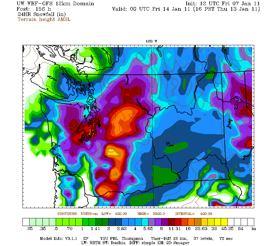
Now, I don't want everybody to get excited. There are often events like this that show up on the models and everybody gets super excited only to have snow not fall at all. Out of three models, two are showing significant snow, and one is showing a snowy transition to rain. I'd say we have a pretty good chance of getting some snow. The question is if we get a switchover to rain, or if it stays all snow and we just get walloped (like above). First, you need to have cold air in place. Cold air will start to filter into the area this weekend, with highs in the mid 30s or so. While I would like to have the air be colder, it is cold enough for snow (air can be above freezing and the precipitation can still be snow, particularly if the air is dry or the precipitation is heavy). Now, take a look at the graphic below.
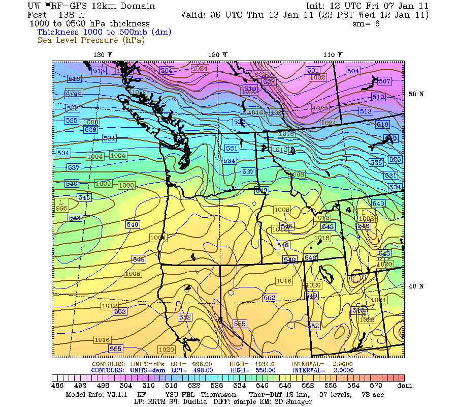
It is important to understand why we might have such a big snow storm, and what ingredients are needed to come together to deliver a potentially historical punch. The scenario shown above is the PERFECT scenario for gobs of snow for Seattle. We have a split jet stream in the upper atmosphere, with one branch coming into our area from Canada and one coming off the Pacific. You can see a developing low pressure system in the far left corner of the picture. This comes onshore just north of Astoria, as evidenced down below.

The crucial key here is that it goes close enough to us to provide us with ample moisture, yet it goes south so it draws in a cold northerly wind. That's why the models are going crazy with snow amounts. If this does verify, we could see the biggest snowfall we have seen in at least 15 years, going back all the way to December 1996.
But it is a big if.
I'll keep you posted. :)
Charlie
0:56
SNOW!!!!!!!!!!!!!!!!!
ReplyDeleteuse ur new system that you made up to predict the chance of snow!
ReplyDelete